Jerash Governorate (Jerash)
Jerash Governorate has the smallest area of the 12 governorates of Jordan, yet it has the second highest density in Jordan after Irbid Governorate. Jerash Governorate is ranked 7th by population.
In the first century of the Christian era this insignificant city (then Gerasa) experienced a fast ascent under Roman rule and the Pax Romana. It became part of the Decapolis and grew increasingly competitive with the older Petra as a commercial town. The inhabitants extracted iron ore from the nearby Ajlun mountains. Starting in the middle of the 1st century, this upswing led to active building and a rich abundance of architectural monuments, still impressive today. In the 2nd century, the Roman expansion wars in Asia led to further gains. Well-made roads were built to Pella, Philadelphia (now Amman), Dion and to the provincial capital Bos(t)ra. Emperor Hadrian visited the city in the winter of 129-130. In the following centuries the political situation in this region changed fundamentally and the city's means declined. During this time also Christianity was on the ascendant and many churches were built. Gerasa had its own bishop—still today it is a Titularbistum—and bishop Placcus (or Plancus) participated in the Council of Chalcedon.
The mathematician Nicomachus of Gerasa came from this city.
The Jerash Governorate was formed in 1994 from a portion of Irbid Governorate.
Map - Jerash Governorate (Jerash)
Map


Country - Jordan
 |
 |
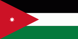
| Flag of Jordan | |
Modern-day Jordan has been inhabited by humans since the Paleolithic period. Three stable kingdoms emerged there at the end of the Bronze Age: Ammon, Moab and Edom. In the third century BC, the Arab Nabataeans established their Kingdom with Petra as the capital. Later rulers of the Transjordan region include the Assyrian, Babylonian, Roman, Byzantine, Rashidun, Umayyad, Abbasid, and the Ottoman empires. After the Great Arab Revolt against the Ottomans in 1916 during World War I, the Greater Syria region was partitioned by Britain and France. The Emirate of Transjordan was established in 1921 by the Hashemite, then Emir, Abdullah I, and the emirate became a British protectorate. In 1946, Jordan gained independence and became officially known in Arabic as the Hashemite Kingdom of Jordan. The country captured the West Bank during the 1948 Arab–Israeli War and annexed it until it was lost to Israel in 1967. Jordan renounced its claim to the territory in 1988, and became the second Arab state to sign a peace treaty with Israel in 1994.
Currency / Language
| ISO | Currency | Symbol | Significant figures |
|---|---|---|---|
| JOD | Jordanian dinar | دا | 3 |
| ISO | Language |
|---|---|
| AR | Arabic language |
| EN | English language |