Kalulushi
Kalulushi is a town in the Copperbelt Province in north central Zambia. It is located on the M18 Road, just west of Kitwe. Municipal (district) population 75,806 at the 2000 census. Kalulushi emerged as a planned company town with the development of mining Companies in the mid-20th century - initially housing the main offices for the Zambia Consolidated Copper Mines. Economic activity in Kalulushi (as well as the surrounding area) declined severely with the closure of 2 Shaft and 7 Shaft Mining sites.
There is a famous story of the origin of the name Kalulushi. The story goes like this. Two gentlemen went hunting for rabbits. Rabbits, in the local Lamba language, are referred to as "kalulu." During their hunt they eventually spotted one rabbit. One of the gentlemen in excitement called out "kalulu!". The other gentlemen quietly told his friend, "shhhh" in order to avoid alarming the rabbit and prevent the rabbit from running away. So that's how the name Kalulushi came about. And so the story goes. Kalulushi was established in 1953 as a company town for workers at the nearby Chibuluma copper and cobalt mine, and it became a public town in 1958. It is located 14 km (9 mi) west of Kitwe, the nearest rail station, at an altitude of 1,260 m (4,130 ft). The city's major employer is Chambishi metals. The Chati Forest Reserve west of the city manages large plantations of eucalyptus, tropical pine, and other exotic tree species supplying wood for the mining industry. The Woods are also supplied to ZESCO an electricity company.
Kalulushi has the second of the two independence stadiums in Zambia and boasts of a unique roundabout which has five (5) roads connecting to it. The town is home to Chibuluma Rugby Club and Kalulushi Modern Stars FC both playing in the country's top flight leagues in rugby and football respectively
* Kalulushi trust school
* Chavuma high school
* Kalulushi high school
* Mitobo Combined school
* Lubuto Basic School
* Masamba Basic School
* Kankonshi secondary school
Map - Kalulushi
Map
Country - Zambia
 |
 |
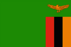
| Flag of Zambia | |
The region was affected by the Bantu expansion of the 13th century. Following the arrival of European explorers in the 18th century, the British colonised the region into the British protectorates of Barotseland-North-Western Rhodesia and North-Eastern Rhodesia comprising 73 tribes, towards the end of the 19th century. These were merged in 1911 to form Northern Rhodesia. For most of the colonial period, Zambia was governed by an administration appointed from London with the advice of the British South Africa Company. On 24 October 1964, Zambia became independent of the United Kingdom and prime minister Kenneth Kaunda became the inaugural president. From 1972 to 1991 Zambia was a one-party state with the United National Independence Party as the sole legal political party under the motto "One Zambia, One Nation" coined by Kaunda. Kaunda was succeeded by Frederick Chiluba of the social-democratic Movement for Multi-Party Democracy in 1991, beginning a period of government decentralisation.
Currency / Language
| ISO | Currency | Symbol | Significant figures |
|---|---|---|---|
| ZMW | Zambian kwacha | ZK | 2 |
| ISO | Language |
|---|---|
| NY | Chichewa language |
| EN | English language |


