Kaohsiung
 |
 |
Since founding in the 17th century, Kaohsiung has grown from a small trading village into the political and economic centre of southern Taiwan, with key industries such as manufacturing, steel-making, oil refining, freight transport and shipbuilding. It is classified as a "Gamma −" level global city by the Globalization and World Cities Research Network, with some of the most prominent infrastructures in Taiwan. The Port of Kaohsiung is the largest and busiest harbor in Taiwan while Kaohsiung International Airport is the second busiest airport in number of passengers. The city is well-connected to other major cities by high speed and conventional rail, as well as several national freeways. It also hosts the Republic of China Navy fleet headquarters and its naval academy. More recent public works such as Pier-2 Art Center, National Kaohsiung Center for the Arts and Kaohsiung Music Center have been aimed at growing the tourism and cultural industries of the city.
Hoklo immigrants to the area during the 16th and 17th centuries called the region Takau. The surface meaning of the associated Chinese characters was "beat the dog". According to one theory, the name Takau originates from the aboriginal Siraya language and translates as "bamboo forest". According to another theory, the name evolved via metathesis from the name of the Makatao tribe, who inhabited the area at the time of European and Hoklo settlement. The Makatao is considered by some to be part of the Siraya tribe.
During the Dutch colonization of southern Taiwan, the area was known as Tancoia to Europeans for a period of about three decades. In 1662, the Dutch were expelled by the Kingdom of Tungning, founded by Ming loyalists of Koxinga. His son, Zheng Jing, renamed the village Banlian-chiu in 1664.
The name of "Takau" was restored in the late 1670s, when the town expanded drastically with immigrants from mainland China and was kept through Taiwan's cession to the Japanese Empire in 1895. In his 1903 general history of Taiwan, US Consul to Formosa James W. Davidson relates that "Takow" was already a well-known name in English. In 1920, the name was changed to Takao (高雄) and administered the area under Takao Prefecture. While the new name had quite a different surface meaning, its pronunciation in Japanese sounded more or less the same as the old name spoken in Hokkien.
After Taiwan was handed to the Republic of China, the name did not change, but the official romanization became Kaohsiung, derived from the Wade-Giles romanization of the Mandarin Chinese pronunciation for 高雄.
The name Takau remains the official name of the city in Austronesian languages of Taiwan such as Rukai, although these are not widely spoken in the city. The name also remains popular locally in the naming of businesses, associations, and events.
Map - Kaohsiung
Map
Country - Taiwan
 |
 |
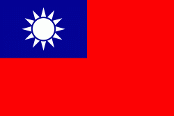
| Flag of Taiwan | |
* in East Asia. It is located at the junction of the East and South China Seas in the northwestern Pacific Ocean, with the People's Republic of China (PRC) to the northwest, Japan to the northeast, and the Philippines to the south. The territories controlled by the ROC consist of 168 islands, with a combined area of 36193 km2. The main island of Taiwan, also known as Formosa, has an area of 35,808 km2, with mountain ranges dominating the eastern two-thirds and plains in the western third, where its highly urbanised population is concentrated. The capital, Taipei, forms along with New Taipei City and Keelung the largest metropolitan area of Taiwan. Other major cities include Taoyuan, Taichung, Tainan, and Kaohsiung. With around 23.9 million inhabitants, Taiwan is among the most densely populated countries in the world.
Currency / Language
| ISO | Currency | Symbol | Significant figures |
|---|---|---|---|
| TWD | New Taiwan dollar | $ | 2 |
| ISO | Language |
|---|---|
| ZH | Chinese language |


