Karlovy Vary Airport (Karlovy Vary Airport)
Karlovy Vary Airport (Letiště Karlovy Vary) is the airport of Karlovy Vary in western Bohemia. It is located in the village of Olšová Vrata, 6 km southeast of the city centre and is the fourth-busiest airport in the Czech Republic. The airport handled 104,469 passengers in 2013, which was a record high.
Plans were announced in 2011 to build a new departure hall at the airport, at an estimated expense of 30 million crowns. 99% of passengers using the airport in 2012 were Russian.
Plans were announced in 2011 to build a new departure hall at the airport, at an estimated expense of 30 million crowns. 99% of passengers using the airport in 2012 were Russian.
| IATA Code | KLV | ICAO Code | LKKV | FAA Code | |
|---|---|---|---|---|---|
| Telephone | Fax | ||||
| Home page | Hyperlink |
Map - Karlovy Vary Airport (Karlovy Vary Airport)
Map


Country - Czech_Republic
 |
 |
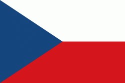
| Flag of the Czech Republic | |
The Duchy of Bohemia was founded in the late 9th century under Great Moravia. It was formally recognized as an Imperial State of the Holy Roman Empire in 1002 and became a kingdom in 1198. Following the Battle of Mohács in 1526, the whole Crown of Bohemia was gradually integrated into the Habsburg monarchy. The Protestant Bohemian Revolt led to the Thirty Years' War. After the Battle of White Mountain, the Habsburgs consolidated their rule. With the dissolution of the Holy Empire in 1806, the Crown lands became part of the Austrian Empire.
Currency / Language
| ISO | Currency | Symbol | Significant figures |
|---|---|---|---|
| CZK | Czech koruna | KÄ | 2 |
| ISO | Language |
|---|---|
| CS | Czech language |
| SK | Slovak language |