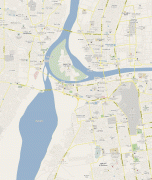
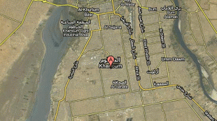
Khartoum
 |
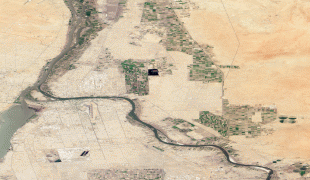
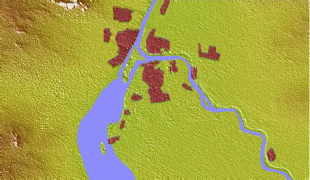
Divided by these two parts of the Nile, Khartoum is a tripartite metropolis with an estimated population of over five million people, consisting of Khartoum proper, and linked by bridges to Khartoum North (الخرطوم بحري al-Kharṭūm Baḥrī) and Omdurman (أم درمان Umm Durmān) to the west.
Khartoum was founded in 1821 as part of Egypt, north of the ancient city of Soba. While the United Kingdom exerted power over Egypt, it left administration of the Sudan to it until Mahdist forces took over Khartoum. The British attempted to evacuate Anglo-Egyptian garrisons from Sudan but the Siege of Khartoum in 1884 resulted in the capture of the city by Mahdist forces and a massacre of the defending Anglo-Egyptian garrison. In 1898 it was reoccupied by British forces, and was the seat of the Anglo-Egyptian Sudan government until 1956.
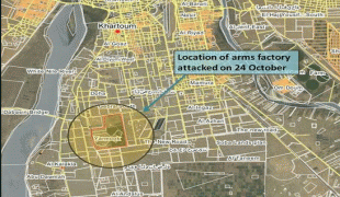
That year the city was designated as the capital of an independent Sudan. In modern times, it has been a site of political unrest, as when three hostages were killed during the Attack on the Saudi Embassy in Khartoum in 1973. In the 21st century, the Justice and Equality Movement engaged in combat there in 2008 with Sudanese government forces as part of the War in Darfur. The Khartoum massacre occurred in 2019 during the Sudanese Revolution.
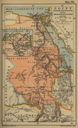
Khartoum is an economic and trade centre in Northern Africa, with rail lines from Port Sudan and El-Obeid. It is served by Khartoum International Airport, and Khartoum New International Airport is under construction. Several national and cultural institutions are in Khartoum and its metropolitan area, including the National Museum of Sudan, the Khalifa House Museum, the University of Khartoum, and the Sudan University of Science and Technology.
The origin of the word Khartoum is uncertain. One theory suggests that it is derived from Arabic khurṭūm (خرطوم, "trunk" or "hose"), probably referring to the narrow strip of land extending between the Blue and White Niles. Dinka scholars argue that the name derives from the Dinka words khar-tuom (Dinka-Bor dialect) or khier-tuom (as is the pronunciation in various Dinka Dialects), translating to "place where rivers meet". This is supported by historical accounts which place the Dinka homeland in central Sudan (around present-day Khartoum) as recently as the 13th-17th centuries A.D.
Captain J.A. Grant, who reached Khartoum in 1863 with Captain Speke's expedition, thought the name was most probably from the Arabic qurtum (قرطم, "safflower", i.e., Carthamus tinctorius), which was cultivated extensively in Egypt for its oil to be used as fuel. Some scholars speculate that the word derives from the Nubian word Agartum ("the abode of Atum"), the Nubian and Egyptian god of creation. Other Beja scholars suggest Khartoum is derived from the Beja word hartoom, "meeting". Sociologist Vincent J. Donovan notes that in the Nilotic Maa language of the Maasai people, khartoum means "we have acquired" and that the geographical location of Khartoum is where Maasai oral tradition claims that the ancestors of the Maasai first acquired cattle.
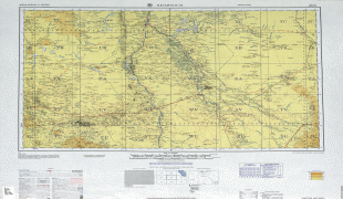
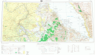
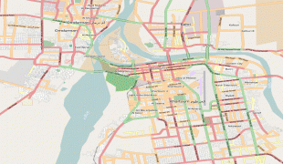
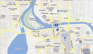
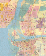
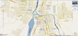
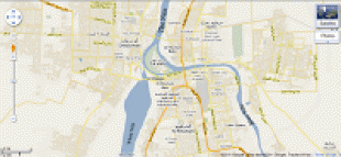
Map - Khartoum
Map


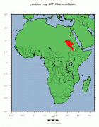
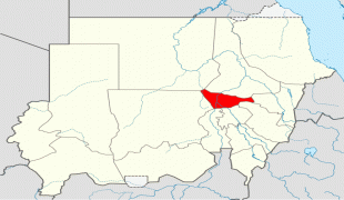
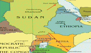
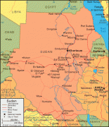
Country - Sudan
 |
 |
| Flag of Sudan | |
Sudan's history goes back to the Pharaonic period, witnessing the Kingdom of Kerma (c. 2500–1500 BC), the subsequent rule of the Egyptian New Kingdom (c. 1500 BC–1070 BC) and the rise of the Kingdom of Kush (c. 785 BC–350 AD), which would in turn control Egypt itself for nearly a century. After the fall of Kush, the Nubians formed the three Christian kingdoms of Nobatia, Makuria, and Alodia, with the latter two lasting until around 1500. Between the 14th and 15th centuries, most of Sudan was gradually settled by Arab nomads. From the 16th to the 19th centuries, central and eastern Sudan were dominated by the Funj sultanate, while Darfur ruled the west and the Ottomans the east.
Currency / Language
| ISO | Currency | Symbol | Significant figures |
|---|---|---|---|
| SDG | Sudanese pound | جس. | 2 |
| ISO | Language |
|---|---|
| AR | Arabic language |
| EN | English language |