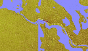
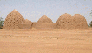
Kousséri
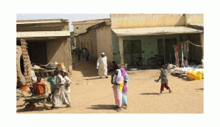
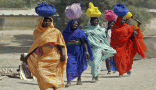
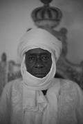
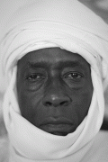
Kousséri (from قصور quṣūr meaning "palaces"), founded and known as Mser in the indigenous Mser language is a city in Far North Province, Cameroon. It is the capital of the Logone-et-Chari department. It is a market town, and its population has recently been swollen by refugees from Chad. It had a population of 89,123 at the 2005 Census. The majority of the population are Shuwa Arabs with Chadian Arabic used as the lingua franca.
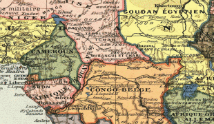
It forms a transborder agglomeration with the city of N'Djamena, capital of Chad, from which it is separated by the Logone River and the Chari River.
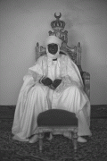
Kousséri was part of the Bornu Empire. In March 1846 Omar (son of Sheik Mohammed), nominal general of the Bornu sultan Ibrahim suffered a defeat at Kousséri. In 1900 the village was occupied by soldiers of Rabij az-Zubayr (Rabih), a Sudanese warlord. On 3 March it was taken by the combined forces of two French expeditions, one under Major Lamy from Algeria and the other under Lt. Paul Joalland from Senegal and local forces opposed to Rabih. Rabih was not in Kousseri at the time but established himself in a fort on the right bank of the Chari. Lamy did not think he had sufficient forces to attack Rabih immediately, but waited until the beginning of April when he was joined by a third expedition that was coming up the Chari under Émile Gentil. When he arrived the combined forces crossed the Chari and attacked Rabih. The battle of Kousséri was a decisive battle which secured French rule over Chad.
It forms a transborder agglomeration with the city of N'Djamena, capital of Chad, from which it is separated by the Logone River and the Chari River.
Kousséri was part of the Bornu Empire. In March 1846 Omar (son of Sheik Mohammed), nominal general of the Bornu sultan Ibrahim suffered a defeat at Kousséri. In 1900 the village was occupied by soldiers of Rabij az-Zubayr (Rabih), a Sudanese warlord. On 3 March it was taken by the combined forces of two French expeditions, one under Major Lamy from Algeria and the other under Lt. Paul Joalland from Senegal and local forces opposed to Rabih. Rabih was not in Kousseri at the time but established himself in a fort on the right bank of the Chari. Lamy did not think he had sufficient forces to attack Rabih immediately, but waited until the beginning of April when he was joined by a third expedition that was coming up the Chari under Émile Gentil. When he arrived the combined forces crossed the Chari and attacked Rabih. The battle of Kousséri was a decisive battle which secured French rule over Chad.
Map - Kousséri
Map


Country - Cameroon
 |
 |
| Flag of Cameroon | |
Early inhabitants of the territory included the Sao civilisation around Lake Chad, and the Baka hunter-gatherers in the southeastern rainforest. Portuguese explorers reached the coast in the 15th century and named the area Rio dos Camarões (Shrimp River), which became Cameroon in English. Fulani soldiers founded the Adamawa Emirate in the north in the 19th century, and various ethnic groups of the west and northwest established powerful chiefdoms and fondoms. Cameroon became a German colony in 1884 known as Kamerun. After World War I, it was divided between France and the United Kingdom as League of Nations mandates. The Union des Populations du Cameroun (UPC) political party advocated independence, but was outlawed by France in the 1950s, leading to the national liberation insurgency fought between French and UPC militant forces until early 1971. In 1960, the French-administered part of Cameroon became independent, as the Republic of Cameroun, under President Ahmadou Ahidjo. The southern part of British Cameroons federated with it in 1961 to form the Federal Republic of Cameroon. The federation was abandoned in 1972. The country was renamed the United Republic of Cameroon in 1972 and back to the Republic of Cameroon in 1984 by a presidential decree by president Paul Biya. Paul Biya, the incumbent president, has led the country since 1982 following Ahidjo's resignation; he previously held office as prime minister from 1975 on. Cameroon is governed as a Unitary Presidential Republic.
Currency / Language
| ISO | Currency | Symbol | Significant figures |
|---|---|---|---|
| XAF | Central African CFA franc | Fr | 0 |
| ISO | Language |
|---|---|
| EN | English language |
| FR | French language |