KwaZulu-Natal
 |
Two areas in KwaZulu-Natal have been declared UNESCO World Heritage Sites: the iSimangaliso Wetland Park and the uKhahlamba Drakensberg Park. These areas are extremely scenic as well as important to the surrounding ecosystems.
During the 1830s and early 1840s, the northern part of what is now KwaZulu-Natal was established as the Zulu Kingdom while the southern part was, briefly, the Boer Natalia Republic before becoming the British Colony of Natal in 1843. The Zulu Kingdom remained independent until 1879.
KwaZulu-Natal is the birthplace of many notable figures in South Africa's history, such as Albert Luthuli, the first non-white and the first person from outside Europe and the Americas to be awarded the Nobel Peace Prize (1960); Pixley ka Isaka Seme, the founder of the African National Congress (ANC) and South Africa's first black lawyer; John Langalibalele Dube, the ANC's founding president; Harry Gwala, ANC member and anti-apartheid activist; Mac Maharaj, grammy award winning group Ladysmith Black Mambazo, grammy award winning DJ Black Coffee, ANC member, anti-apartheid activist and Little Rivonia Trial defendant; Mangosuthu Buthelezi, the founder of the Inkatha Freedom Party (IFP); Anton Lembede, the founding president of the ANC Youth League; Jacob Zuma, the former President of South Africa; Bhambatha, a 19th-century Zulu chief who became an anti-apartheid icon; and Shaka Zulu.
At around 92,100 km2 in area, KwaZulu-Natal is roughly the size of Portugal. It has three different geographic areas and is the eastern most province in the country. The lowland region along the Indian Ocean coast is extremely narrow in the south, widening in the northern part of the province, while the central Natal Midlands consists of an undulating hilly plateau rising toward the west. Two mountainous areas, the western Drakensberg Mountains and northern Lebombo Mountains form, respectively, a solid basalt wall rising over 3000 m beside Lesotho border and low parallel ranges of ancient granite running southward from Eswatini. The area's largest river, the Tugela, flows west to east across the center of the province.
The coastal regions typically have subtropical thickets and deeper ravines; steep slopes host some Afromontane Forest. The midlands have moist grasslands and isolated pockets of Afromontane Forest. The north has a primarily moist savanna habitat, whilst the Drakensberg region hosts mostly alpine grassland.
The province contains rich areas of biodiversity of a range of flora and fauna. The iSimangaliso Wetland Park and the uKhahlamba Drakensberg Park have been declared UNESCO World Heritage Sites. The iSimangaliso Wetland Park, along with uKhahlamba Drakensberg Park and Ndumo, are wetlands of international importance for migratory species, and are designated as Ramsar sites. South Africa signed the 1971 Ramsar Convention to try to conserve and protect important wetlands because of their importance to habitats and numerous species.
The former Eastern Cape enclave of the town of Umzimkulu and its hinterland have been incorporated into KwaZulu-Natal following the 12th amendment of the Constitution of South Africa. The amendment also made other changes to the southern border of the province.
The northwesterly line of equal latitude and longitude traverses the province from the coast at Hibberdene (-30.57639°N, 30.57639°W) to northeast Lesotho.
The province became the first to include a portion of road that is made of partial plastic, the equivalent of nearly 40,000 recycled milk cartons.
Map - KwaZulu-Natal
Map


Country - South_Africa
 |
 |
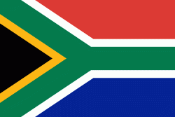
| Flag of South Africa | |
About 80% of the population are Black South Africans. The remaining population consists of Africa's largest communities of European (White South Africans), Asian (Indian South Africans and Chinese South Africans), and multiracial (Coloured South Africans) ancestry. South Africa is a multiethnic society encompassing a wide variety of cultures, languages, and religions. Its pluralistic makeup is reflected in the constitution's recognition of 11 official languages, the fourth-highest number in the world. According to the 2011 census, the two most spoken first languages are Zulu (22.7%) and Xhosa (16.0%). The two next ones are of European origin: Afrikaans (13.5%) developed from Dutch and serves as the first language of most Coloured and White South Africans; English (9.6%) reflects the legacy of British colonialism and is commonly used in public and commercial life.
Currency / Language
| ISO | Currency | Symbol | Significant figures |
|---|---|---|---|
| ZAR | South African rand | Rs | 2 |
| ISO | Language |
|---|---|
| AF | Afrikaans language |
| EN | English language |
| ST | Sotho language |
| SS | Swati language |
| TS | Tsonga language |
| TN | Tswana language |
| VE | Venda language |
| XH | Xhosa language |
| ZU | Zulu language |


