La Digue (La Digue)
La Digue is the third most populated island of the Seychelles, and fourth largest by land area, lying east of Praslin and west of Felicite Island. In size, it is the fourth-largest granitic island of Seychelles after Mahé, Praslin and Silhouette Island. It has a population of 2,800 people. Most of the inhabitants live in the west coast villages of La Passe (linked by ferry to Praslin and Mahé) and Anse Réunion. There is no airport on La Digue, so to get there from a foreign country, one must fly to Victoria and continue by ferry, usually via Praslin. It has an area of 10.08 km2, which makes it relatively easy to travel around by bike or on foot.
La Digue was named after a ship in the fleet of French explorer Marc-Joseph Marion du Fresne, who visited the Seychelles in 1768.
According to modern historians, La Digue was first sighted by the French navigator Lazare Picault in 1742, but it was not named until 1768. The first people settled on the island in 1789, when French colonists arrived with their African slaves. Most of them went back to France, but some people were left and some of today's inhabitants carry their names. Later, more French deportees arrived, followed by a large number of liberated slaves and Asian immigrants. In 1854, the first Catholic chapel was built on La Digue by Father Theophile. Most inhabitants of the island are of the Catholic faith. French colonists on La Digue manufactured coral lime, and they are believed to be responsible for the decline of the island's coral reefs. They also made copra out of coconuts, and they planted vanilla on their plantations. This tradition has been continued.
Map - La Digue (La Digue)
Map
Country - Seychelles
 |
|
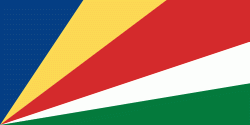
| Flag of Seychelles | |
Seychelles was uninhabited prior to being encountered by Europeans in the 16th century. It faced competing French and British interests until coming under full British control in the late 18th century. Since proclaiming independence from the United Kingdom in 1976, it has developed from a largely agricultural society to a market-based diversified economy, characterized by rapidly rising service, public sector, and tourism activities. From 1976 to 2015, nominal GDP grew nearly 700%, and purchasing power parity nearly 1600%. Since the late 2010s, the government has taken steps to encourage foreign investment.
Currency / Language
| ISO | Currency | Symbol | Significant figures |
|---|---|---|---|
| SCR | Seychelles rupee | ₨ | 2 |
| ISO | Language |
|---|---|
| EN | English language |
| FR | French language |


