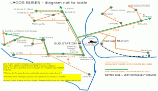
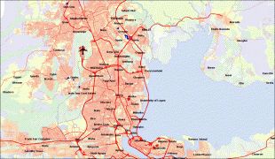
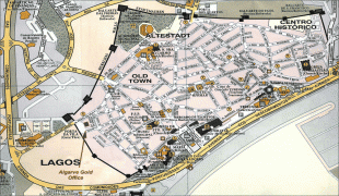
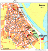
Lagos
 |
 |
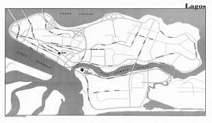
Lagos initially emerged as a home to the Awori subgroup of the Yoruba of West Africa and later emerged as a port city of the Benin Empire that originated on a collection of islands, which are contained in the present day Local Government Areas (LGAs) of Lagos Island, Eti-Osa, Amuwo-Odofin and Apapa. The islands are separated by creeks, fringing the southwest mouth of Lagos Lagoon, while being protected from the Atlantic Ocean by barrier islands and long sand spits such as Bar Beach, which stretch up to 100 km east and west of the mouth. Due to rapid urbanization, the city expanded to the west of the lagoon to include areas in the present day Lagos Mainland, Ajeromi-Ifelodun, and Surulere. This led to the classification of Lagos into two main areas: the Island, which was the original city of Lagos, and the Mainland, which it has since expanded into. This city area was governed directly by the Federal Government through the Lagos City Council, until the creation of Lagos State in 1967, which led to the splitting of Lagos city into the present-day seven Local Government Areas (LGAs), and an addition of other towns (which now make up 13 LGAs) from the then Western Region to form the state.
However, the state capital was later moved to Ikeja in 1976, and the federal capital moved to Abuja in 1991. Even though Lagos is still widely referred to as a city, the present-day Lagos, also known as "Metropolitan Lagos", and officially as "Lagos Metropolitan Area" is an urban agglomeration or conurbation, consisting of 16 LGAs including Ikeja, the state capital of Lagos State. This conurbation makes up 37% of Lagos State total land area, but houses about 85% of the state's total population.
The exact population of Metropolitan Lagos is disputed. In the 2006 federal census data, the conurbation had a population of about 8 million people. However, the figure was disputed by the Lagos State Government, which later released its own population data, putting the population of Lagos Metropolitan Area at approximately 16 million. Daily, the Lagos area is growing by some 3,000 people or around 1.1 million annually, so the true population figure of the greater Lagos area in 2022 is roughly 28 million (up from some 23.5 million in 2018). Lagos may therefore have overtaken Kinshasa as Africa's most populous city. As of 2015, unofficial figures put the population of "Greater Metropolitan Lagos", which includes Lagos and its surrounding metro area, extending as far as into Ogun State, at approximately 21 million.
Lagos was originally inhabited by the Awori subgroup of the Yoruba people in the 15th century. The Awori moved to an island now called Iddo and then to the larger Lagos Island. The Aworis who were predominantly fishermen and hunters called it Oko. Because the area was dominated by the then expansive Oyo Empire, they called it Eko, from the late 16th century to the mid-19th century. The name Eko was given to it by its first Awori traditional settlers, Oba Ado. Eko is still the native name for Lagos to date.
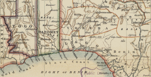
Lagos (Portuguese for "lakes") was a name given to the settlement by the Portuguese. Throughout history, it was home to a number of warring ethnic Yoruba groups who had settled in the area. Following its early settlement by the Awori nobility, the state first came to the attention of the Portuguese in the 15th century.
Portuguese explorer Rui de Sequeira visited the area in 1472, naming the area around the city Lago de Curamo, which means Lake of Curamo.
In Britain's early 19th-century fight against the transatlantic slave trade, its West Africa Squadron or Preventative Squadron as it was also known, continued to pursue Portuguese, American, French, and Cuban slave ships and to impose anti-slavery treaties with West African coastal chiefs with so much doggedness that they created a strong presence along the West African coast from Sierra Leone all the way to the Niger Delta (today's Nigeria) and as far south as Congo. In 1849, Britain appointed John Beecroft Consul of the Bights of Benin and Biafra, a position he held (along with his governorship of Fernando Po) until his death in 1854. John Duncan was appointed Vice Consul and was located at Whydah. At the time of Beecroft's appointment, the Kingdom of Lagos (under Oba Kosoko) was in the western part of the Consulate of the Bights of Benin and Biafra and was a key slave trading port. In 1851 and with pressure from liberated slaves who now wielded political and business influence, Britain intervened in Lagos in what is now known as the Bombardment of Lagos or Capture of Lagos resulting in the installation of Oba Akitoye and the ouster of Oba Kosoko. Oba Akitoye then signed the Treaty between Great Britain and Lagos abolishing slavery. The signing of the 1852 treaty ushered in the Consular Period in Lagos' history wherein Britain provided military protection for Lagos.
Following threats from Kosoko and the French who were positioned at Whydah, a decision was made by Lord Palmerston (British Prime Minister) who noted in 1861, "the expediency of losing no time in assuming the formal Protectorate of Lagos". William McCoskry, the Acting Consul in Lagos with Commander Bedingfield convened a meeting with Oba Dosunmu on 30 July 1861 aboard HMS Prometheus where Britain's intent was explained and a response to the terms were required by August 1861. Dosunmu resisted the terms of the treaty but under the threat to unleash a bombardment on Lagos by Commander Bedingfield, Dosunmu relented and signed the Lagos Treaty of Cession on 6 August 1861.
Lagos was declared a colony on 5 March 1862. The remainder of modern-day Nigeria was seized in 1887, and when the Colony and Protectorate of Nigeria was established in 1914, Lagos became its capital, continuing as such after the country's independence from Britain in 1960. Along with migrants from all over Nigeria and other West African nations were the returnee ex-slaves known as Creoles, who came from Freetown, Sierra Leone, Brazil, and the West Indies to Lagos. The Creoles contributed to Lagos' modernization and their knowledge of Portuguese architecture can still be seen from the architecture on Lagos Island. Since the 19th century, Lagos gradually transformed into a melting pot of Africans and Europeans. Railway links and telephone cables connecting Lagos to London had been established by 1886. Electric street lighting was introduced in the city in 1898.
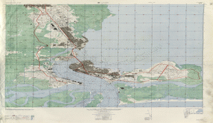
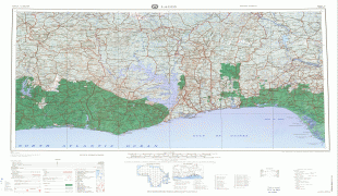
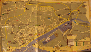
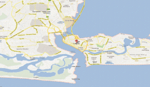
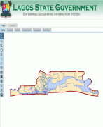
Map - Lagos
Map


Country - Nigeria
 |
 |
| Flag of Nigeria | |
Nigeria has been home to several indigenous pre-colonial states and kingdoms since the second millennium BC, with the Nok civilization in the 15th century BC, marking the first internal unification in the country. The modern state originated with British colonialization in the 19th century, taking its present territorial shape with the merging of the Southern Nigeria Protectorate and Northern Nigeria Protectorate in 1914 by Lord Lugard. The British set up administrative and legal structures while practising indirect rule through traditional chiefdoms in the Nigeria region. Nigeria became a formally independent federation on 1 October 1960. It experienced a civil war from 1967 to 1970, followed by a succession of military dictatorships and democratically elected civilian governments until achieving a stable democracy in the 1999 presidential election. The 2015 general election was the first time an incumbent president failed to be re-elected.
Currency / Language
| ISO | Currency | Symbol | Significant figures |
|---|---|---|---|
| NGN | Nigerian naira | ₦ | 2 |
| ISO | Language |
|---|---|
| EN | English language |
| HA | Hausa language |
| IG | Igbo language |
| YO | Yoruba language |