Lebap Province (Lebap)
Lebap Region (Lebap welaýaty/Лебап велаяты from the Persian لب آب Lab-e āb) is one of the regions of Turkmenistan. It is in the northeast of the country, bordering Afghanistan, Uzbekistan along the Amu Darya. Its capital is Türkmenabat (formerly named Çärjew). It has an area of 93,727 square kilometers, and a population of 1,334,500 people (2005 est.).
The name Lebap is a Turkmenized form of the Persian Lab-e āb, which means "riverside" and has long been used to designate the middle reaches of the Amu Darya.
It contains the Repetek Nature Reserveas well as the Köýtendag Nature Reserve, which includes Turkmenistan's highest mountain, Aýrybaba (3137 meters). Lebap is also home to the Dayahatyn caravansaray.
The region is located along the Amu Darya. The Kyzylkum Desert is located on the east side of the river and Karakum Desert is located on the west side of the river. About three-quarters of the region's land area is in the Karakum Desert. The region's sunny weather and abundance of water resources help produce high-quality long-staple cotton.
The region of present-day Lebap once occupied a spot along the Silk Road. The 9th-10th century caravansaray of Dayahatyn is located within Lebap.
Map - Lebap Province (Lebap)
Map
Country - Turkmenistan
 |
 |
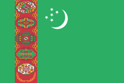
| Flag of Turkmenistan | |
Turkmenistan has long served as a thoroughfare for other nations and cultures. Merv is one of the oldest oasis-cities in Central Asia, and was once the biggest city in the world. It was also one of the great cities of the Islamic world and an important stop on the Silk Road. Annexed by the Russian Empire in 1881, Turkmenistan figured prominently in the anti-Bolshevik movement in Central Asia. In 1925, Turkmenistan became a constituent republic of the Soviet Union, the Turkmen Soviet Socialist Republic (Turkmen SSR); it became independent after the dissolution of the Soviet Union in 1991.
Currency / Language
| ISO | Currency | Symbol | Significant figures |
|---|---|---|---|
| TMT | Turkmenistan manat | m | 2 |
| ISO | Language |
|---|---|
| RU | Russian language |
| TK | Turkmen language |
| UZ | Uzbek language |


