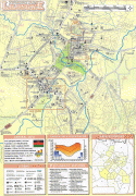
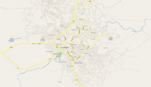
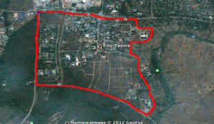
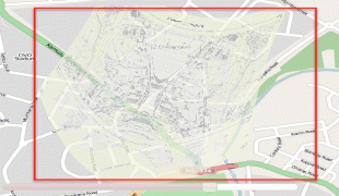
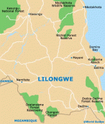
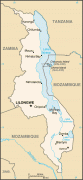
Lilongwe
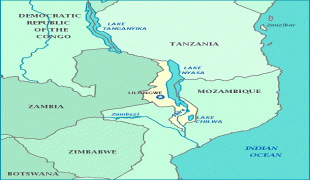
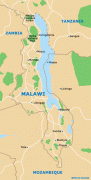
Lilongwe is the capital and most populated city of the African country of Malawi. It has a population of 989,318 as of the 2018 Census, up from a population of 674,448 in 2008. In 2020 that figure was 1,122,000. The city is located in the central region of Malawi, in the district of the same name, near the borders with Mozambique and Zambia, and it is an important economic and transportation hub for central Malawi. It is named after the Lilongwe River.
Lilongwe was first set up as a boma by the local leader Njewa in 1902. It became an administrative center in 1904. In the 1920s, its location at the junction of several major roadways increased its importance as an agricultural market centre for the fertile Central Region Plateau.
As a trading post, Lilongwe was officially recognised as a town in 1947. After gaining independence, it increasingly developed into an important trading centre in Malawi's central region.
In 1965, Malawi's first president, Hastings Kamuzu Banda, selected it as an economic growth point for northern and central Malawi.
Lilongwe became the capital of Malawi in 1975, replacing the previous capital, Zomba. The last government offices were relocated to Lilongwe in 2005.
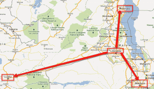
Development projects of the 1970s and 1980s included the construction of Lilongwe International Airport, which serves the city; rail connections to Salima to the east and the Zambian border to the west; industrial areas in the northern part of the city; and an agricultural program for the fertile tobacco lands of the Central Region Plateau. Lilongwe's population continues to experience rapid growth.
The city's population is increasing rapidly, with an annual growth rate of 4.3%.
Lilongwe was first set up as a boma by the local leader Njewa in 1902. It became an administrative center in 1904. In the 1920s, its location at the junction of several major roadways increased its importance as an agricultural market centre for the fertile Central Region Plateau.
As a trading post, Lilongwe was officially recognised as a town in 1947. After gaining independence, it increasingly developed into an important trading centre in Malawi's central region.
In 1965, Malawi's first president, Hastings Kamuzu Banda, selected it as an economic growth point for northern and central Malawi.
Lilongwe became the capital of Malawi in 1975, replacing the previous capital, Zomba. The last government offices were relocated to Lilongwe in 2005.
Development projects of the 1970s and 1980s included the construction of Lilongwe International Airport, which serves the city; rail connections to Salima to the east and the Zambian border to the west; industrial areas in the northern part of the city; and an agricultural program for the fertile tobacco lands of the Central Region Plateau. Lilongwe's population continues to experience rapid growth.
The city's population is increasing rapidly, with an annual growth rate of 4.3%.
Map - Lilongwe
Map


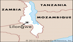

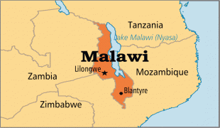
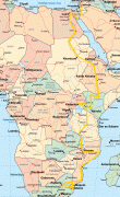


Country - Malawi
 |
 |
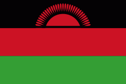
| Flag of Malawi | |
In 1891, the area was colonised by the British and became a protectorate of the United Kingdom known as Nyasaland. In 1953, it became a protectorate within the semi-independent Federation of Rhodesia and Nyasaland. The Federation was dissolved in 1963. In 1964, the protectorate was ended: Nyasaland became an independent country under Queen Elizabeth II, and was renamed Malawi. Two years later it became a republic. It gained full independence from the United Kingdom, and by 1970 had become a totalitarian one-party state under the presidency of Hastings Banda, who remained in this role until 1994. Malawi has a democratic, multi-party republic headed by an elected president. Lazarus Chakwera of the Malawi Congress Party led the Tonse Alliance grouping of nine political parties and won the court-mandated Presidential Election rerun held on 23 June 2020 after the May 2019 Presidential Election was annulled due to electoral irregularities. The country's military, the Malawian Defence Force, includes an army, a navy, and an air wing. Malawi's foreign policy is pro-Western. It maintains positive diplomatic relations with most countries, and participates in several international organisations, including the United Nations, the Commonwealth of Nations, the Southern African Development Community (SADC), the Common Market for Eastern and Southern Africa (COMESA), and the African Union (AU).
Currency / Language
| ISO | Currency | Symbol | Significant figures |
|---|---|---|---|
| MWK | Malawian kwacha | MK | 2 |
| ISO | Language |
|---|---|
| NY | Chichewa language |