Loreto Region (Loreto)
* Northwest: Ecuador: Sucumbíos Province, Orellana Province, Pastaza Province and Morona-Santiago Province
* North: Colombia: Putumayo Department
* Northeast: Colombia: Amazonas Department
* East: Brazil: Amazonas State and Acre State
* South: Ucayali and Huánuco regions
* West: San Martín and Amazonas regions
Loreto's large territory comprises parts of the High and Low Jungle, and is largely covered with thick vegetation.
This territory has wide river flood plains, which are covered with rainwater and usually are swamped in summer. In these flood areas there are elevated sectors called restingas, which always remain above water, even in times of the greatest swellings. There are numerous lagoons known as cochas and tipishcas, surrounded by marshy areas with abundant grass vegetation.
Numerous rivers cross Loreto's territory, all of which are part of the Amazonian Hydrographical System. Most of them are navigable. The main river crossing the region is the Amazon, one of the world's most important rivers. Its numerous curves are always changing and sometimes make for a difficult journey. The width between banks of the Amazon sometimes measures a staggering 4 km. The Yavari River runs from Peru to Brazil, the Putumayo River serves as part of the border with Colombia, and the Ucayali and Marañón rivers penetrate Loreto after going through the Pongo de Manseriche.
Map - Loreto Region (Loreto)
Map
Country - Peru
 |
 |
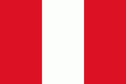
| Flag of Peru | |
Peruvian territory was home to several cultures during the ancient and medieval periods, and has one of the longest histories of civilization of any country, tracing its heritage back to the 10th millennium BCE. Notable pre-colonial cultures and civilizations include the Caral-Supe civilization (the earliest civilization in the Americas and considered one of the cradles of civilization), the Nazca culture, the Wari and Tiwanaku empires, the Kingdom of Cusco, and the Inca Empire, the largest known state in the pre-Columbian Americas.
Currency / Language
| ISO | Currency | Symbol | Significant figures |
|---|---|---|---|
| PEN | Peruvian sol | S/ | 2 |
| ISO | Language |
|---|---|
| AY | Aymara language |
| QU | Quechua language |
| ES | Spanish language |


