Malaita Province (Malaita Province)
 |
The provincial capital and largest urban center is Auki, which was established as the Administrative center for Malaita Province in 1909. Tourism is largely underdeveloped in Malaita; Auki is near to the Langa Langa Lagoon, which provides opportunities for snorkeling, and the villagers provide shell making demonstrations.
The population of the province is 122,620 (1999). The area of the province is 4225 km². The Melanesian population of Malaita has unique cultural traditions in social aspects of life. Brideprice is a tradition which is unique to Malaita compared to the other islands of the Solomon Islands. In this practice the groom's parents present customary money of shells and food to the bride's parents.
The people of the main island are of Melanesian ethnicity. The outer islands of Ontong Java and Sikaiana are of a Polynesian ethnicity and are recognised as Polynesian outliers of Polynesian culture.
Map - Malaita Province (Malaita Province)
Map


Country - Solomon_Islands
 |
 |
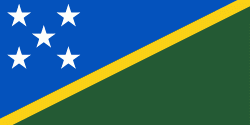
| Flag of the Solomon Islands | |
The islands have been settled since at least some time between 30,000 and 28,800 BCE, with later waves of migrants, notably the Lapita people, mixing and producing the modern indigenous Solomon Islanders population. In 1568, the Spanish navigator Álvaro de Mendaña was the first European to visit them. Though not named by Mendaña, it is believed that the islands were called "the Solomons" by those who later received word of his voyage and mapped his discovery. Mendaña returned decades later, in 1595, and another Spanish expedition, led by Portuguese navigator Pedro Fernandes de Queirós, visited the Solomons in 1606. Britain defined its area of interest in the Solomon Islands archipelago in June 1893, when Captain Gibson, R.N., of HMS Curacoa (1878), declared the southern Solomon Islands a British protectorate. During World War II, the Solomon Islands campaign (1942–1945) saw fierce fighting between the United States, British Commonwealth forces and the Empire of Japan, including the Battle of Guadalcanal.
Currency / Language
| ISO | Currency | Symbol | Significant figures |
|---|---|---|---|
| SBD | Solomon Islands dollar | $ | 2 |
| ISO | Language |
|---|---|
| EN | English language |