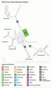
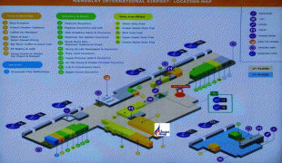
Mandalay International Airport (Mandalay International Airport)
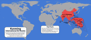
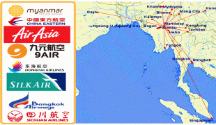
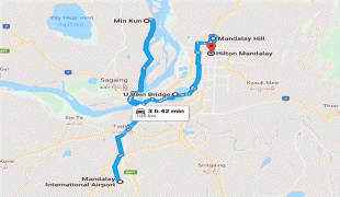
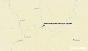
Mandalay International Airport (မန္တလေး အပြည်ပြည်ဆိုင်ရာ လေဆိပ်; ), located 35 km south of Mandalay in Tada-U, is one of three international airports in Myanmar. Completed in 1999, it was the largest and most modern airport in the country until the modernization of Yangon International Airport in 2008. The airport connects 11 domestic and seven international destinations. Its 4267 m runway is the longest runway in use in Southeast Asia and has the capacity to handle up to 3 million passengers a year.
The Mandalay International Airport project was first conceived by the Burmese military government in the mid-1990s as a way to increase overall levels of foreign investment and tourism in Myanmar. With Yangon boasting the only other international airport in the whole country, the new Mandalay airport was regarded as crucial in achieving a planned 10% annual passenger growth. The hope was for Mandalay to become a hub for flights to other major Asian cities, in particular Beijing, Hanoi, Bangkok, Kolkata, and Dhaka.
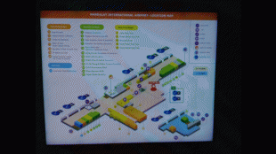
On 16 November 2014, a consortium of Mitsubishi Group and an affiliate from Japan Airlines signed a concession agreement with the Myanmar government to operate the airport for 30 years. The joint firm undertook the operation, rehabilitation, and maintenance of airport facilities, including terminal buildings and the airport's sole runway, excluding air traffic control, with operations having begun around March 2015. The agreement's main focus is to generate further expansion of domestic and international flights to Mandalay and to increase passenger traffic through the airport.
The Mandalay International Airport project was first conceived by the Burmese military government in the mid-1990s as a way to increase overall levels of foreign investment and tourism in Myanmar. With Yangon boasting the only other international airport in the whole country, the new Mandalay airport was regarded as crucial in achieving a planned 10% annual passenger growth. The hope was for Mandalay to become a hub for flights to other major Asian cities, in particular Beijing, Hanoi, Bangkok, Kolkata, and Dhaka.
On 16 November 2014, a consortium of Mitsubishi Group and an affiliate from Japan Airlines signed a concession agreement with the Myanmar government to operate the airport for 30 years. The joint firm undertook the operation, rehabilitation, and maintenance of airport facilities, including terminal buildings and the airport's sole runway, excluding air traffic control, with operations having begun around March 2015. The agreement's main focus is to generate further expansion of domestic and international flights to Mandalay and to increase passenger traffic through the airport.
| IATA Code | MDL | ICAO Code | VYMD | FAA Code | |
|---|---|---|---|---|---|
| Telephone | Fax | ||||
| Home page |
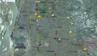
Map - Mandalay International Airport (Mandalay International Airport)
Map


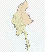
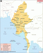
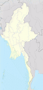
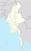
Country - Burma
 |
 |
| Flag of Myanmar | |
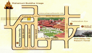
Early civilisations in the area included the Tibeto-Burman-speaking Pyu city-states in Upper Myanmar and the Mon kingdoms in Lower Myanmar. In the 9th century, the Bamar people entered the upper Irrawaddy valley, and following the establishment of the Pagan Kingdom in the 1050s, the Burmese language, culture, and Theravada Buddhism slowly became dominant in the country. The Pagan Kingdom fell to Mongol invasions, and several warring states emerged. In the 16th century, reunified by the Taungoo dynasty, the country became the largest empire in the history of Southeast Asia for a short period.
Currency / Language
| ISO | Currency | Symbol | Significant figures |
|---|---|---|---|
| MMK | Myanmar kyat | Ks | 2 |
| ISO | Language |
|---|---|
| MY | Burmese language |