Mexico City (Ciudad de México)
 |
 |
The 2020 population for the city proper was 9,209,944, with a land area of 1495 km2. According to the most recent definition agreed upon by the federal and state governments, the population of Greater Mexico City is 21,804,515, which makes it the sixth-largest metropolitan area in the world, the second-largest urban agglomeration in the Western Hemisphere (behind São Paulo, Brazil), and the largest Spanish-speaking city (city proper) in the world. Greater Mexico City has a GDP of $411 billion in 2011, which makes it one of the most productive urban areas in the world. The city was responsible for generating 15.8% of Mexico's GDP, and the metropolitan area accounted for about 22% of the country's GDP. If it were an independent country in 2013, Mexico City would be the fifth-largest economy in Latin America.
Mexico's capital is both the oldest capital city in the Americas and one of two founded by Indigenous people. The city was originally built on a group of islands in Lake Texcoco by the Mexica (Aztecs) around 1325, under the name Tenochtitlan. It was almost completely destroyed in the 1521 siege of Tenochtitlan and subsequently redesigned and rebuilt in accordance with the Spanish urban standards. In 1524, the municipality of Mexico City was established, known as México Tenochtitlán, and as of 1585, it was officially known as Ciudad de México (Mexico City). Mexico City was the political, administrative, and financial center of a major part of the Spanish colonial empire. After independence from Spain was achieved, the federal district was created in 1824.
After years of demanding greater political autonomy, residents were finally given the right to elect both a head of government and the representatives of the unicameral Legislative Assembly by election in 1997. Ever since, left-wing parties (first the Party of the Democratic Revolution and later the National Regeneration Movement) have controlled both of them. The city has several progressive policies, such as elective abortions, a limited form of euthanasia, no-fault divorce, and same-sex marriage. On 29 January 2016, it ceased to be the Federal District (Distrito Federal or D.F.) and is now officially known as Ciudad de México (or CDMX), with a greater degree of autonomy. A clause in the Constitution of Mexico, however, prevents it from becoming a state within the Mexican federation, as it is the seat of power in the country, unless the capital of the country were to be relocated elsewhere.
Mexico City was traditionally known as La Ciudad de los Palacios ("the City of the Palaces"), a nickname attributed to Baron Alexander von Humboldt when visiting the city in the 19th century, who, sending a letter back to Europe, said Mexico City could rival any major city in Europe. But it was English politician Charles Latrobe who really penned the following: "... look at their works: the moles, aqueducts, churches, roads—and the luxurious City of Palaces which has risen from the clay-builts ruins of Tenochtitlan...", on page 84 of the Letter V of The Rambler in Mexico. During the colonial period, the city's motto was "Muy Noble e Insigne, Muy Leal e Imperial" (Very Noble and Distinguished, Very Loyal and Imperial). During Andrés López Obrador's administration a political slogan was introduced: la Ciudad de la Esperanza ("The City of Hope"). This motto was quickly adopted as a city nickname but has faded since the new motto, Capital en Movimiento ("Capital in Movement"), was adopted by the administration headed by Marcelo Ebrard, though the latter is not treated as often as a nickname in media. Since 2013, to refer to the city, particularly in relation to government campaigns, the abbreviation CDMX has been used (from Ciudad de México), prior to this but recently, the abbreviation was "DF" (from Distrito Federal de México).
The city is colloquially known as Chilangolandia after the locals' nickname chilangos. Chilango is used pejoratively by people living outside Mexico City to "connote a loud, arrogant, ill-mannered, loutish person". For their part those living in Mexico City designate insultingly those who live elsewhere as living in la provincia ("the provinces", the periphery) and many proudly embrace the term chilango. Residents of Mexico City are more recently called defeños (deriving from the postal abbreviation of the Federal District in Spanish: D.F., which is read "De-Efe"). They are formally called capitalinos (in reference to the city being the capital of the country), but "[p]erhaps because capitalino is the more polite, specific, and correct word, it is almost never utilized".
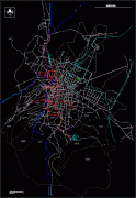
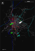
Map - Mexico City (Ciudad de México)
Map


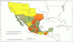

Country - Mexico


Currency / Language
| ISO | Currency | Symbol | Significant figures |
|---|---|---|---|
| MXV | Mexican Unidad de Inversion | 2 | |
| MXN | Mexican peso | $ | 2 |
| ISO | Language |
|---|---|
| ES | Spanish language |
