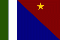
Milne Bay is a province of Papua New Guinea. Its capital is Alotau. The province covers 14,345 km² of land and 252,990 km² of sea, within the province there are more than 600 islands, about 160 of which are inhabited. The province has about 276,000 inhabitants, speaking about 48 languages, most of which belong to the Eastern Malayo-Polynesian branch of the Austronesian language family. Economically the province is dependent upon tourism, oil palm, and gold mining on Misima Island; in addition to these larger industries there are many small-scale village projects in cocoa and copra cultivation. The World War II Battle of Milne Bay took place in the province.
Culturally the Milne Bay region is sometimes referred to as "the Massim," a term originating from the name of Misima Island. Massim societies are usually characterized by matrilineal descent, elaborate mortuary sequences and complex systems of ritual exchange including the Kula ring. From island group to island group and even between close lying islands, the local culture changes remarkably. What is socially acceptable on one island may not be so on another.
The Milne Bay Province became a major base in World War II. The Australian Armed Forces operated HMAS Ladava base that won the Battle of Milne Bay in 1942. The US Navy built a large base in Milne Bay Province, Naval Base Milne Bay.


