Mokolo
Mokolo is the departmental capital and largest city of the Mayo-Tsanaga department, in the Far North Province of Cameroon. It is the fourth largest city in the Far North Province, after Maroua, Yagoua, and Kousséri. It is located in the Mandara Mountains that run along the Cameroonian-Nigerian border.
Fulbé (also known as Fulani) and Mafa peoples dominate the Mokolo area. Historically, the Mafa were the original inhabitants. When the Fulbé came through the area, many of the Mafa dispersed into the surrounding Mandara Mountains. The Mafa are also known as the Matakam, a name given by the Fulbé, meaning “well-dressed.”
In 1916 Mokolo was subordinate to Madagali, a Nigerian town, and was ruled from there. Mokolo was centrally located along a well-traveled trade route. The Guiziga and Fulbé peoples living near Maroua traded salt and natron with the Mafa living further West, who provided red earth and herbs, used for dyeing cloth.
In roughly 1947 the Muslim Lamido (traditional chief) Idrissou came to power in Mokolo. Idrissou did not wish to manage the affaires of the animist Mafa populations. He appointed one of his subordinates, an Islamized Mafa named Mamoudou, to govern the animists. Mamoudou came to be accepted as the Lamido of the Mafa, and subordinate to Idrissou, who was recognized as Lamido to the Muslim Fulbé population. Eventually, the Mafa revolted against paying taxes to both the Lamibé (plural of Lamido). Seemingly under pressure of French colonialists living in the area, Idrissou was obliged to release Mamoudou from his subordinate position. To this day two Lamibé remain in Mokolo, separately but cooperatively serving both the Fulbé and Mafa populations. For a small fee, the Lamibé resolve problems and disputes, namely concerning marriages and divorce, inheritances, and some petty theft. The Lamido thus serves as a link between the populations and the government.
Map - Mokolo
Map
Country - Cameroon
 |
 |
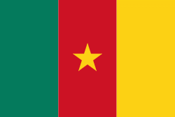
| Flag of Cameroon | |
Early inhabitants of the territory included the Sao civilisation around Lake Chad, and the Baka hunter-gatherers in the southeastern rainforest. Portuguese explorers reached the coast in the 15th century and named the area Rio dos Camarões (Shrimp River), which became Cameroon in English. Fulani soldiers founded the Adamawa Emirate in the north in the 19th century, and various ethnic groups of the west and northwest established powerful chiefdoms and fondoms. Cameroon became a German colony in 1884 known as Kamerun. After World War I, it was divided between France and the United Kingdom as League of Nations mandates. The Union des Populations du Cameroun (UPC) political party advocated independence, but was outlawed by France in the 1950s, leading to the national liberation insurgency fought between French and UPC militant forces until early 1971. In 1960, the French-administered part of Cameroon became independent, as the Republic of Cameroun, under President Ahmadou Ahidjo. The southern part of British Cameroons federated with it in 1961 to form the Federal Republic of Cameroon. The federation was abandoned in 1972. The country was renamed the United Republic of Cameroon in 1972 and back to the Republic of Cameroon in 1984 by a presidential decree by president Paul Biya. Paul Biya, the incumbent president, has led the country since 1982 following Ahidjo's resignation; he previously held office as prime minister from 1975 on. Cameroon is governed as a Unitary Presidential Republic.
Currency / Language
| ISO | Currency | Symbol | Significant figures |
|---|---|---|---|
| XAF | Central African CFA franc | Fr | 0 |
| ISO | Language |
|---|---|
| EN | English language |
| FR | French language |


