Mongomo
Mongomo is a town in the province of Wele-Nzas on mainland Equatorial Guinea, on the eastern border, roughly 1 km (0.62 mi) west of Gabon's Woleu-Ntem Province.
Its cathedral basilica of the Immaculate Conception is the episcopal see of the Roman Catholic Diocese of Mongomo.
Its cathedral basilica of the Immaculate Conception is the episcopal see of the Roman Catholic Diocese of Mongomo.
Map - Mongomo
Map


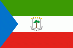
Country - Equatorial_Guinea
 |
 |
| Flag of Equatorial Guinea | |
Equatorial Guinea consists of two parts, an insular and a mainland region. The insular region consists of the islands of Bioko (formerly Fernando Pó) in the Gulf of Guinea and Annobón, a small volcanic island which is the only part of the country south of the equator. Bioko Island is the northernmost part of Equatorial Guinea and is the site of the country's capital, Malabo. The Portuguese-speaking island nation of São Tomé and Príncipe is located between Bioko and Annobón. The mainland region, Río Muni, is bordered by Cameroon on the north and Gabon on the south and east. It is the location of Bata, Equatorial Guinea's largest city, and Ciudad de la Paz, the country's planned future capital. Rio Muni also includes several small offshore islands, such as Corisco, Elobey Grande, and Elobey Chico. The country is a member of the African Union, Francophonie, OPEC and the CPLP.
Currency / Language
| ISO | Currency | Symbol | Significant figures |
|---|---|---|---|
| XAF | Central African CFA franc | Fr | 0 |
| ISO | Language |
|---|---|
| FR | French language |
| ES | Spanish language |