Map - Moyen-Chari Region (Moyen-Chari Region)

Moyen-Chari Region (Moyen-Chari Region)
Moyen-Chari (شاري الأوسط) is one of the 23 regions of Chad, located in the south of the country. Its capital is Sarh. The former prefecture of the same name was larger and included modern Mandoul Region.

The region borders Guéra Region to the north, Salamat Region to the east, the Central African Republic to the south, and Mandoul Region, Tandjilé Region and Chari-Baguirmi to the west. The region is largely flat savannah, with parts of the region protected as part of the Manda National Park. Lake Iro, a suspected impact crater, is located in the north-east.

 
Map - Moyen-Chari Region (Moyen-Chari Region)
Country - Chad
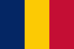
Flag of Chad
Chad, officially the Republic of Chad, is a landlocked country at the crossroads of North and Central Africa. It is bordered by Libya to the north, Sudan to the east, the Central African Republic to the south, Cameroon to the southwest, Nigeria to the southwest (at Lake Chad), and Niger to the west. Chad has a population of 16 million, of which 1.6 million live in the capital and largest city of N'Djamena.

Chad has several regions: a desert zone in the north, an arid Sahelian belt in the centre and a more fertile Sudanian Savanna zone in the south. Lake Chad, after which the country is named, is the second-largest wetland in Africa. Chad's official languages are Arabic and French. It is home to over 200 different ethnic and linguistic groups. Islam (55.1%) and Christianity (41.1%) are the main religions practiced in Chad.
Currency / Language  
ISO Currency Symbol Significant figures
XAF Central African CFA franc Fr 0
Neighbourhood - Country  
  •  Cameroon 
  •  Central African Republic 
  •  Libya 
  •  Niger 
  •  Nigeria 
  •  Sudan 
Administrative Subdivision
Country, State, Region,...
City, Village,...