Nagasaki Prefecture (Nagasaki Prefecture)
 |
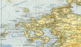
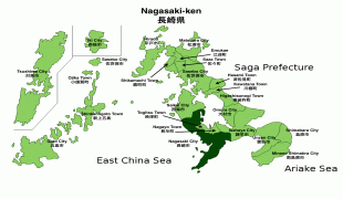
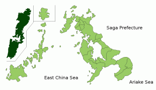
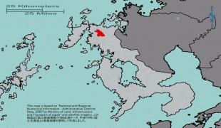
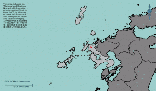
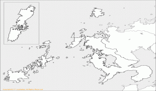
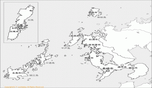
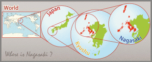
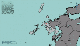
Nagasaki is the capital and largest city of Nagasaki Prefecture, with other major cities including Sasebo, Isahaya, and Ōmura. Nagasaki Prefecture is located in western Kyūshū with a territory consisting of many mainland peninsulas centered around Ōmura Bay, as well as islands and archipelagos including Tsushima and Iki in the Korea Strait and the Gotō Islands in the East China Sea. Nagasaki Prefecture is known for its century-long trading history with the Europeans and as the sole place of direct trade and exchange between Japan and the outside world during the Sakoku period. Nagasaki Prefecture is home to several of the Hidden Christian Sites in the Nagasaki Region which have been declared a UNESCO World Heritage Site.
Nagasaki Prefecture was created by merging of the western half of the former province of Hizen with the island provinces of Tsushima and Iki. Facing China and Korea, the region around Hirado was a traditional center for traders and pirates.
During the 16th century, Catholic missionaries and traders from Portugal arrived and became active in Hirado and Nagasaki, which became a major center for foreign trade. After being given free rein in Oda Nobunaga's period, the missionaries were forced out little by little, until finally, in the Tokugawa era, Christianity was banned under the Sakoku national isolation policy: Japanese foreign trade was restricted to Chinese and Dutch traders based at Dejima in Nagasaki. However, Kirishitan (Japanese Christian) worship continued underground. These Kakure Kirishitan (hidden Christians) were tried at every step, forced to step on fumi-e ("trample pictures", images of the Virgin Mary and saints) to prove that they were non-Christian. With the banishment of all Catholic missionaries, traders from Catholic countries were also forced out of the country. Along with them, their children, half Japanese and half European, were forced to leave. The majority was sent to Jagatara (Jakarta) and are still remembered by the locals as the people who wrote the poignant letters which were smuggled across the sea to their homeland.
Today, Nagasaki has prominent Catholic churches, and the Hidden Christian Sites in the Nagasaki Region, have been included on the UNESCO World Heritage List.
During the Meiji Restoration, Nagasaki and Sasebo became major ports for foreign trade, and eventually major military bases and shipbuilding centers for the Imperial Japanese Navy and the Mitsubishi Heavy Industries up to World War II. On August 9, 1945, the United States dropped an atomic bomb on Nagasaki, which destroyed all buildings in a 1.6 km radius from the point of impact and extensively damaged other parts of the city. Roughly 39,000 people were killed, including 27,778 Japanese munitions workers, 2,000 Korean forced workers, and 150 Japanese soldiers. About 68-80% of the industrial production was destroyed to the point it would not recover for months or at least a year.
Nagasaki Prefecture contains many areas prone to heavy rain and landslide damage. In July 1957, mainly in the Isahaya area, damage from heavy rains, flooding and landslides lead to a death toll of 586, with 136 people missing and 3,860 injured. In July 1982, typhoon damage in the Nagasaki area lead to 299 fatalities, according to a report by the Japanese government.
Map - Nagasaki Prefecture (Nagasaki Prefecture)
Map


Country - Japan
 |
 |
| Flag of Japan | |
Japan is the eleventh most populous country in the world, as well as one of the most densely populated and urbanized. About three-fourths of the country's terrain is mountainous, concentrating its population of 124.8 million on narrow coastal plains. Japan is divided into 47 administrative prefectures and eight traditional regions. The Greater Tokyo Area is the most populous metropolitan area in the world, with more than 37.2 million residents.
Currency / Language
| ISO | Currency | Symbol | Significant figures |
|---|---|---|---|
| JPY | Japanese yen | ¥ | 0 |
| ISO | Language |
|---|---|
| JA | Japanese language |


