Nadroga-Navosa Province (Nandronga and Navosa Province)
Nadroga-Navosa (Nadroga: Nadrogā-Navoha) is one of the fourteen provinces of Fiji and one of eight based in Viti Levu, Fiji's largest island. It is about 2,385 square kilometers and occupies the South-West and Central areas of Viti Levu, Fiji's principal island. The province includes the Mamanuca Archipelago, off the west coast of Viti Levu, Vatulele (or Vahilele in the Nadroga dialect), as well as the remote Conway Reef in the southwest. The population at the 2017 census was 58,931, being the fifth largest province. The main town in Nadroga-Navosa is Sigatoka, with a population of 9622 (2007 census).
Nadroga/Navosa's principal town is Sigatoka, situated near the mouth of the Sigatoka River.
Nadroga is famous for its sunshine and white sandy beaches. Navosa remains wild, with the region significantly less developed than Nadroga. However, it is an area of rushing rivers, deep ravines and rugged mountains. The province of Nadroga-Navosa encompasses contrasting landscapes: the rugged and mountainous northern edges towards Viti Levu's interior, sand dunes and floodplains, to rolling hills of its hinterland, roamed by the province's symbol — the wild horse. Nadroga's coast is famous for its fine beaches and lagoons. The Mamanucas, a chain of reef-fringed islands off the western coast of Viti Levu are popular tourist and surfing destinations. Nadroga's coastal belt is an integral part of Fiji's Coral Coast — containing its leading hotels and resorts such as Shangri-La's Fijian Resort, Outrigger Fiji Beach Resort, Intercontinental Fiji Golf Resort & Spa, and others. Popular areas in Nadroga include Tavarua Island, Natadola Beach, Korotogo, Sigatoka, the Sand Dunes and the "Salad Bowl of Fiji" (Valley Road).
The Sigatoka Sand Dunes, a world heritage site and one of Fiji's principal archeological and historical locations, is in the province, about half a mile from Sigatoka Town. In July 1989, the dunes were designated as Fiji's first national park under the management of the National Trust of Fiji Islands. This distinct feature covers an area of 650 hectares and offers a rich combination of geomorphological, ecological, cultural and aesthetical attributes. The national park is of great importance for educational and recreational use and is a milestone in Fiji's drive for environment. The Sigatoka valley is known as the salad bowl of Fiji.
Other sites of great historical value are the 'Tavuni Hillfort' site (an ancient Tongan fortified settlement in the Sigatoka Valley) and the 'Momi Gunsite' (the site of two long-range cannons and played sentry to Momi Bay during World War II). Furthermore, Kula Eco Park which is a centre for conserving and housing native flora and fauna adds to the steps made by Nadroga and Fiji to safeguard the treasures of the islands.
Nadroga is of immense historical and archaeological importance. The Lapita people made their settlements in the province, the first in the country being at Bourewa, Nadroga. Nadroga was one of the larger states of Fiji in pre-colonial times.
Map - Nadroga-Navosa Province (Nandronga and Navosa Province)
Map
Country - Fiji
 |
 |
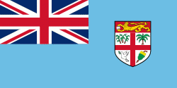
| Flag of Fiji | |
The majority of Fiji's islands were formed by volcanic activity starting around 150 million years ago. Some geothermal activity still occurs today on the islands of Vanua Levu and Taveuni. The geothermal systems on Viti Levu are non-volcanic in origin and have low-temperature surface discharges (of between roughly 35 and 60 C).
Currency / Language
| ISO | Currency | Symbol | Significant figures |
|---|---|---|---|
| FJD | Fijian dollar | $ | 2 |
| ISO | Language |
|---|---|
| EN | English language |
| FJ | Fijian language |


