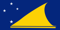
Nukunonu
Nukunonu is the largest atoll within Tokelau, a dependency of New Zealand, in the south Pacific Ocean. It comprises 30 islets surrounding a central lagoon, with about 5.5 km2 of land area and a lagoon surface area of 109 km2. Motuhaga is the only islet that has inhabitants. It has an estimated population of 448.
The first European vessel known to have come upon Nukunonu was the Royal Navy ship HMS Pandora (1779), in 1791, whose captain, Edward Edwards, named Duke of Clarence Island in honor of Prince William, Duke of Clarence and St Andrews (1765-1837), the third son of King George III and later king himself, as William IV. At the time, the Pandora was searching for mutineers from HMS Bounty. During the early 19th century, Nukunonu's inhabitants were converted to Roman Catholicism by Samoan missionaries.
Between 1856 and 1979, the United States claimed that it held sovereignty over the island and the other Tokelauan atolls. In 1979, the U.S. conceded that Tokelau was under New Zealand sovereignty, and a maritime boundary between Tokelau and American Samoa was established by the Treaty of Tokehega.
Map - Nukunonu
Map
Country - Tokelau
 |
 |
Tokelau has a population of approximately 1,500 people; it has the fourth-smallest population of any sovereign state or dependency in the world. As of the 2016 census, around 45% of its residents had been born overseas, mostly in Samoa or New Zealand. The populace has a life expectancy of 69, which is comparable to that of other Oceanian island nations. Approximately 94% of the population speak Tokelauan as their first language. Tokelau has the smallest economy of any nation, although it is a leader in renewable energy, being the first 100% solar-powered nation in the world.
Currency / Language
| ISO | Currency | Symbol | Significant figures |
|---|---|---|---|
| NZD | New Zealand dollar | $ | 2 |
| ISO | Language |
|---|---|
| EN | English language |


