Nyköping
 |
Including Arnö, the locality on the southern shore of the bay just a couple of kilometres from the city centre, Nyköping would have above 36,000 inhabitants. Commonly, Arnö is referred to as a part of the city proper. It forms a wider conurbation with the neighbouring minor municipality and town of Oxelösund 10 km south of its outskirts. The municipality is much larger, although sparsely populated outside of the urban area.
Nyköping directly translates to Newmarket into English. The prefix Ny is translated as New and köping is an old Swedish word for a market place and a commonly used suffix for cities in the south central region of the country (see Köping). The city is located near the open Baltic Sea on the Stadsfjärden inlet, and is regarded as a coastal location. Rivers Nyköpingsån and Kilaån reach the Baltic Sea through the southern end of downtown. The former river splits the town down the middle into an eastern and western part. There are multiple other inlets in the municipality, which has an extensive shoreline.
Typical of the region, the landscape is influenced by post-glacial rebound after the latest ice age. For thousands of years, the land of downtown Nyköping was an archipelago where the hills in town today formed many islands, while the flatter parts of the town were the seafloor. With four peaks above 50 m, the highest point within town limits is 59 m at Ekensberg in the northeastern fringes.
Nyköping is also the home of Stockholm Skavsta Airport which is located less than 10 km from the city centre. Nyköping is part of the wider area of the Mälaren Valley, located around 100 km south of inner Stockholm and 60 km east of Norrköping, the nearest larger city. The municipal border between Nyköping and Norrköping marks the point where the historical lands Götaland and Svealand converge on the east coast.
It retains an oceanic/continental climate hybrid, causing warm summers and winters around the freezing point with variable snow cover.
The area bears traces of settlers since around 2000 BC. In the early medieval age, around 1000 AD, Nyköping was a capital of one of the many Swedish petty kingdoms. In the 13th century, construction on the Nyköping Fortress begun; the following century it became the strongest fortress in the country. The coat of arms probably depicts the fortress, or one of its towers.
In 1317 the Nyköping Banquet took place, a renowned episode in Sweden's history, when King Birger of Sweden captured his two brothers as revenge for earlier sufferings and had them imprisoned without food until they starved to death. (See Nyköpings gästabud.)
The earliest known charter dates from 1444, making it one of the now defunct Cities in Sweden. In the 16th century Nyköping became the seat of Duke Charles, who later became Charles IX of Sweden. With the status of a Royal residential seat, Nyköping was at its peak of development. In 1665 large parts of the city including the fortress were damaged in a fire. The same thing happened again in 1719 when Russian troops invaded the city. It was then rebuilt with its current street plan.
Nyköping was industrialized relatively early compared to the rest of Sweden. In the early 19th century, textile industry was established, and the population soon rose as Nyköping's industry grew. In 1879, C.A. Wedholms mejerikärlsfabrik was founded, starting to produce milk churns. Wedholms still has activity in Nyköping and is a milk cooling tank manufacturer.
Map - Nyköping
Map
Country - Sweden
 |
 |
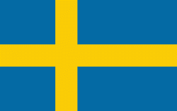
| Flag of Sweden | |
Nature in Sweden is dominated by forests and many lakes, including some of the largest in Europe. Many long rivers run from the Scandes range through the landscape, primarily emptying into the northern tributaries of the Baltic Sea. It has an extensive coastline and most of the population lives near a major body of water. With the country ranging from 55°N to 69°N, the climate of Sweden is diverse due to the length of the country. The usual conditions are mild for the latitudes with a maritime south, continental centre and subarctic north. Snow cover is infrequent in the densely populated south, but reliable in higher latitudes. Furthermore, the rain shadow of the Scandes results in quite dry winters and sunny summers in much of the country.
Currency / Language
| ISO | Currency | Symbol | Significant figures |
|---|---|---|---|
| SEK | Swedish krona | kr | 2 |
| ISO | Language |
|---|---|
| FI | Finnish language |
| SE | Northern Sami |
| SV | Swedish language |


