Nzérékoré Region (Nzerekore Region)
The Nzérékoré Region is a region in the southern part of Guinea. Its capital and largest city is Nzérékoré. It is one of the eight regions of Guinea. It is bordered by the countries of Sierra Leone, Liberia, and Ivory Coast, and the Guinean regions of Kankan and Faranah.
Nzérékoré Region is divided into six prefectures; which are further sub-divided into 66 sub-prefectures:
* Beyla Prefecture
* Guéckédou Prefecture
* Lola Prefecture
* Macenta Prefecture
* Nzérékoré Prefecture
* Yomou Prefecture
Nzérékoré Region is divided into six prefectures; which are further sub-divided into 66 sub-prefectures:
* Beyla Prefecture
* Guéckédou Prefecture
* Lola Prefecture
* Macenta Prefecture
* Nzérékoré Prefecture
* Yomou Prefecture
Map - Nzérékoré Region (Nzerekore Region)
Map


Country - Guinea
 |
 |
| Flag of Guinea | |
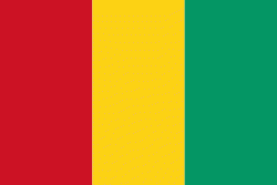
Formerly French Guinea, it achieved independence in 1958. It has a history of military coups d'état. After decades of authoritarian rule, in 2010 it held its first democratic election. As it continued to hold multi-party elections, the country continued to face ethnic conflicts, corruption, and abuses by military and police. In 2011, the United States government claimed that torture by security forces and abuse of women and children (including female genital mutilation) were ongoing human rights issues. In 2021, a military faction overthrew president Alpha Condé and suspended the constitution.
Currency / Language
| ISO | Currency | Symbol | Significant figures |
|---|---|---|---|
| GNF | Guinean franc | Fr | 0 |
| ISO | Language |
|---|---|
| FR | French language |