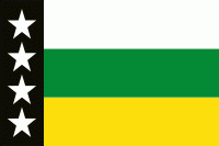
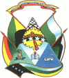
Orellana is an inland province of Ecuador. The capital is Puerto Francisco de Orellana (also known as Coca). It was created on July 30, 1998, from part of Napo Province.
The name of the province derives from the explorer Francisco de Orellana who it is told to have sailed from somewhere near the town to the Atlantic Ocean. He did this trip several times looking for the gold city of El Dorado and in search of a rumored Nutmeg forest which at the time was a very expensive spice. During his voyages he met a ferocious tribe of Indians who attacked his ships and many among them were women. This led to the naming of the river as the Amazon river. The province is divided in four cantons.
The province is divided into four cantons. The following table lists each with its population at the 2001 census, its area in square kilometres (km²), and the name of the canton seat or capital.