Orientale (Orientale Province)
The District of Orientale Province was created from Stanley Falls District on 15 July 1898. The district was expanded to become Orientale Province in 1913. It was divided in 1933 into Costermansville (later Kivu) and Stanleyville Province. Stanleyville Province was renamed Orientale Province from 1947 to 1963, when it was broken up into Kibali-Ituri, Uélé and Haut-Congo provinces. Orientale Province was reconstituted in 1966. Between 1971 and 1997 it was called Haut-Zaïre, then it returned to the name of Orientale. The province contained the Bas-Uele, Haut-Uele, Ituri and Tshopo districts. These were elevated to provinces in 2015 under the 2006 constitution.
The province lay in the northeast of the country. Originally it bordered Équateur to the west, Congo-Kasaï to the southwest and Katanga to the south. After being reduced in size, it bordered Équateur to the west, Kasaï-Oriental province to the southwest, Maniema to the south, and North Kivu to the southeast. It also bordered the Central African Republic and South Sudan to the north, and Uganda to the east. The provincial capital was Stanleyville, later renamed Kisangani.
On 15 July 1898 the Stanley Falls District became the District of Orientale Province (District de la province Orientale), with Stanleyville as its headquarters. The Lualaba District in the south was split off at this time. The district was also called Stanleyville District. In 1910 the new vice-government general of Katanga was formed the south, with parts of Lualaba District and parts of Stanleyville.
Orientale/Oost Province was formed in 1913 in the Belgian Congo from the District of Orientale Province, expanded to include Haut-Uélé, Bas-Uélé and Aruwimi. The new province contained the districts of Bas-Uele, Haut-Uele, Ituri, Stanleyville, Aruwimi, Maniema, Lowa and Kivu. It was divided in 1933 into Costermansville (later Kivu) and Stanleyville Province. Stanleyville Province was renamed Orientale/Oost Province from 1947 to 1963, when it was broken up into Kibali-Ituri, Uélé and Haut-Congo provinces. Orientale Province was reconstituted in 1966 from the amalgamation of the Uele, Kibali-Ituri and Haut-Congo provinces. In 2015 it was dissolved into the provinces of Bas-Uélé, Haut-Uélé, Ituri and Tshopo.
In 1998 the Orientale villages of Durba and Watsa were the center of an outbreak of Marburg virus disease among gold mine workers.
The Ituri district of Orientale was the scene of the Ituri conflict.
As of 2014, militia groups continue to fight in the province and have reportedly committed many atrocities against the local population, such as forcing women into sex slavery and forcing men to work in mines.
Map - Orientale (Orientale Province)
Map
Country - Democratic_Republic_of_the_Congo
 |
 |
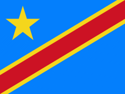
| Flag of the Democratic Republic of the Congo | |
Centered on the Congo Basin, the territory of the DRC was first inhabited by Central African foragers around 90,000 years ago and was reached by the Bantu expansion about 3,000 years ago. In the west, the Kingdom of Kongo ruled around the mouth of the Congo River from the 14th to 19th centuries. In the northeast, center and east, the kingdoms of Azande, Luba, and Lunda ruled from the 16th and 17th centuries to the 19th century. King Leopold II of Belgium formally acquired rights to the Congo territory in 1885 and declared the land his private property, naming it the Congo Free State. From 1885 to 1908, his colonial military forced the local population to produce rubber and committed widespread atrocities. In 1908, Leopold ceded the territory, which thus became a Belgian colony.
Currency / Language
| ISO | Currency | Symbol | Significant figures |
|---|---|---|---|
| CDF | Congolese franc | Fr | 2 |
| ISO | Language |
|---|---|
| FR | French language |
| KG | Kongo language |
| LN | Lingala language |


