Map - Pardubice Region (Pardubický kraj)

Pardubice Region (Pardubický kraj)
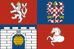
Pardubice Region (Pardubický kraj; Pardubitzer Region, ; Kraj pardubicki) is an administrative unit (kraj) of the Czech Republic, located mainly in the eastern part of its historical region of Bohemia, with a small part in northwestern Moravia. It is named after its capital Pardubice. As an administrative unit, Pardubice Region has existed three times in the course of history. It was established for the first time in 1850, and extended from Český Brod to the Bohemian-Moravian border. In its second existence, it was one of 19 regions as they were set between 1949 and 1960. After 1960, Pardubice became the capital of Pardubice district, which was part of the Eastern Bohemian Region (capital Hradec Králové). The Pardubice Region, as it is now, was reestablished in 2000.

The Pardubice Region is divided into 4 districts:

There are a total of 451 municipalities in the region (as of 2019). Among these are 15 municipalities with extended powers and 26 municipalities with a delegated municipal office. Thirty-two of the municipalities are classified as towns. The regional central offices are in Pardubice.

 
Map - Pardubice Region (Pardubický kraj)
Map
Openstreetmap - Map - Pardubice Region
Openstreetmap
Map - Pardubice Region - Esri.WorldImagery
Esri.WorldImagery
Map - Pardubice Region - Esri.WorldStreetMap
Esri.WorldStreetMap
Map - Pardubice Region - OpenStreetMap.Mapnik
OpenStreetMap.Mapnik
Map - Pardubice Region - OpenStreetMap.HOT
OpenStreetMap.HOT
Map - Pardubice Region - CartoDB.Positron
CartoDB.Positron
Map - Pardubice Region - CartoDB.Voyager
CartoDB.Voyager
Map - Pardubice Region - OpenMapSurfer.Roads
OpenMapSurfer.Roads
Map - Pardubice Region - Esri.WorldTopoMap
Esri.WorldTopoMap
Map - Pardubice Region - Stamen.TonerLite
Stamen.TonerLite
Country - Czech_Republic
Flag of the Czech Republic
The Czech Republic, also known as Czechia, is a landlocked country in Central Europe. Historically known as Bohemia, it is bordered by Austria to the south, Germany to the west, Poland to the northeast, and Slovakia to the southeast. The Czech Republic has a hilly landscape that covers an area of 78871 km2 with a mostly temperate continental and oceanic climate. The capital and largest city is Prague; other major cities and urban areas include Brno, Ostrava, Plzeň and Liberec.

The Duchy of Bohemia was founded in the late 9th century under Great Moravia. It was formally recognized as an Imperial State of the Holy Roman Empire in 1002 and became a kingdom in 1198. Following the Battle of Mohács in 1526, the whole Crown of Bohemia was gradually integrated into the Habsburg monarchy. The Protestant Bohemian Revolt led to the Thirty Years' War. After the Battle of White Mountain, the Habsburgs consolidated their rule. With the dissolution of the Holy Empire in 1806, the Crown lands became part of the Austrian Empire.
Currency / Language  
ISO Currency Symbol Significant figures
CZK Czech koruna Kč 2
Neighbourhood - Country  
  •  Austria 
  •  Germany 
  •  Poland 
  •  Slovakia 
Administrative Subdivision
Country, State, Region,...
Airport