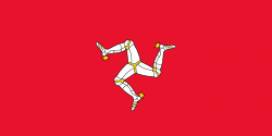
Peel (Peel)
Peel (Purt ny h-Inshey – Port of the Island) is a seaside town and small fishing port in the Isle of Man, in the historic parish of German but administered separately. Peel is the third largest town in the island after Douglas and Ramsey but the fourth largest settlement, as Onchan has the second largest population but is classified as a village. Until 2016 (when it was merged with Glenfaba) Peel was also a House of Keys constituency, electing one Member of the House of Keys (MHK), who, from September 2015, was Ray Harmer. Peel has a ruined castle on St Patrick's Isle, and a cathedral, seat of the Diocese of Sodor and Man (the diocese was founded when Mann was ruled by the Norse).
Peel is on the west coast of the Isle of Man, on the east side of the mouth of the River Neb. To the north west is St Patrick's Isle, connected to the mainland by a causeway, and to the west across the river is Peel Hill. The A1 road connects Peel with Douglas. The A4 and A3 roads connect it with Kirk Michael and Ramsey. To the south of Peel is Castletown, the former capital of the island, and to the SE is Douglas. Ireland to the west and Scotland to the north may be seen on a clear day.
The older part of Peel is built of reddish Peel Sandstone, mostly the original homes and businesses of fishermen and merchants with narrow winding lanes by the quayside. Before 1765, the town had a busy import-export trade importing goods from ports such as Amsterdam; in the mid to late 19th century the town was a busy fishing port.
Map - Peel (Peel)
Map
Country - Isle_of_Man
 |
 |
Humans have lived on the island since before 6500 BC. Gaelic cultural influence began in the 5th century AD, when Irish missionaries following the teaching of St. Patrick began settling the island, and the Manx language, a branch of the Goidelic languages, emerged. In 627, King Edwin of Northumbria conquered the Isle of Man along with most of Mercia. In the 9th century, Norsemen established the thalassocratic Kingdom of the Isles, which included the Isle of Man. Magnus III, King of Norway from 1093 to 1103, reigned as King of Mann and the Isles between 1099 and 1103.
Currency / Language
| ISO | Currency | Symbol | Significant figures |
|---|---|---|---|
| GBP | Pound sterling | £ | 2 |
| ISO | Language |
|---|---|
| EN | English language |
| GV | Manx language |


