Lenggong (Pekan Lenggong)
Lenggong (Jawi: لڠڬوڠ) is a town, a mukim and a parliamentary constituency in Hulu Perak District, Perak, Malaysia. The Lenggong valley in Hulu Perak is one of Peninsular Malaysia's most important areas for archaeology, as excavations have revealed many traces of Malaysia's prehistory. It is the site of the oldest known place of human activity in the Peninsula. Today it is still a rural area, with small kampongs surrounded by green vegetation and limestone hills. Lenggong can be likened to an open-air museum, and is home to legends, skeletons, cave drawings and precious finds such as jewellery, pottery, weapons and stone tools. Many of the caves in the Lenggong area have revealed evidence of ancient humans having lived and hunted in this area. The Lenggong Valley was listed by UNESCO as a World Heritage site on 30 June 2012.
Lenggong is accessible by trunk roads connecting it with neighbouring towns and cities. The town of Lenggong is situated some 100 kilometres north of Ipoh on the Kuala Kangsar to Grik road (highway 76). The road to Lenggong is surrounded mostly by oil palm estates and jungles. As cows and buffalo are part of the agriculture, they are often seen along the road. The jungles (about million years old) are now in danger of heavy illegal logging.
To visit Lenggong, from the North–South Expressway take Exit No.143 at Kuala Kangsar – that's about 3 hours away from Kuala Lumpur. Then take Route 76 to Lenggong. The new highway is open and has replaced the old scenic kampung road.
Map - Lenggong (Pekan Lenggong)
Map
Country - Malaysia
 |
 |
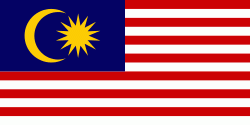
| Flag of Malaysia | |
Malaysia has its origins in the Malay kingdoms, which, from the 18th century on, became subject to the British Empire, along with the British Straits Settlements protectorate. Peninsular Malaysia was unified as the Malayan Union in 1946. Malaya was restructured as the Federation of Malaya in 1948 and achieved independence on 31 August 1957. The independent Malaya united with the then British crown colonies of North Borneo, Sarawak, and Singapore on 16 September 1963 to become Malaysia. In August 1965, Singapore was expelled from the federation and became a separate independent country.
Currency / Language
| ISO | Currency | Symbol | Significant figures |
|---|---|---|---|
| MYR | Malaysian ringgit | RM | 2 |
| ISO | Language |
|---|---|
| ZH | Chinese language |
| EN | English language |
| MS | Malay language |
| ML | Malayalam language |
| PA | Panjabi language |
| TA | Tamil language |
| TE | Telugu language |
| TH | Thai language |


