Penafiel Municipality (Penafiel)
 |
 |
The region was occupied since pre-history, as evidenced by the proliferation of megalithic monuments, stone settlements and castros. This includes the Menhir of Luzim, a 2.5 m tall stone dating to an occupation of 3–4000 years B.C. Similarly, in the civil parish of Luzim, are the rock engravings that have existed for 3000 years. In addition, there are various rock forts (castros), subject of archaeological studies, such as the archaeological "city of the dead" in Citânia de Monte Mozinho. One of the largest in the Iberian Peninsula, it was the precursor to the Galician organized community of Cividade Gallaeci; the hill fort is dotted with traces of various cultures: Galician-Lusitanian, Roman, Visigoth and Moorish. There different legends that indicate the origins of the name Penafiel, although the common thread associates it with the many forts situated in the locality.
With the consolidation and incorporation into the Roman world, these hill forts were reorganized and moved down from the hilltops, dispersing into concentrated settlements in open areas and encircled by cultivated parcels, such as in Bouça do Ouro (Boelhe). The Roman spa town of São Vicente do Pinheiro was an example of these centres, developing around the natural resources in the region. In addition, vains of gold interspersed in the Schist and Quartzite quarries attracted Roman settlers from the empire, resulting in an intense artisanal economy, supported by the circulation of a single currency, culture and language.
In the 9th century, activity became concentrated in the Civitas Anegia on the headwaters of the Tâmega and Douro, that dominated the lands along margins of those rivers. This civitas was the precursor of Penafiel de Canas, an area that assumed an import role, but occupied a smaller area and embryonic place that concentrated on agriculture and fishing. The lands were seats of the Romanesque ecclesiastical seigneurs of the Benedictine monasteries of Paço de Sousa and Bustelo. Supporting a rich cultural influence, Paço de Sousa boasted a magnificent Romanesque architecture and gave shelter to the historian Egas Moniz Ribadouro, schoolmaster of Afonso Henriques. Other noble houses of medieval period include Barbosa de Honor (Rans), with its tower overlooking agricultural lands, or the transformed tower of Coreixas (Irivo). Romanesque religious architecture proliferated during the post-Roman period; the Romanesque temple of Boelhe or Church of São Salvador da Gândara (venerating a deceased saint's skull) attracted pilgrims to the region, as did the Church of Abragão, the late-Gothic Church of São Miguel da Eja and the funerary memorial of Ermida (Irivo).
During this time emerged a new reality: a fortified settlement that developed in the parish of Moazares, home of the Romanesque church of Santa Luzia (circled by sculpted tombs) was along the banks of the river, along the roadway from Porto and crossing the Sousa at the medieval bridge of Cepeda was an ideal local to build an urban community to specialize in services, artesnal commerce and sale of manufactured goods, supported by a medieval fair. The area was known as Arrifana de Sousa. Legend suggests that name came from the name Ariana (the daughter of Hermenegildo González and D. Mumadona Dias) who, following her father's death, inherited the land in the 10th century.
At its founding, it was dominated by two castles: one along the northern bank of the Sousa river, called the Castle of Aguiar de Sousa and the second along the southern margin, called Pena. The town was attacked several times by Moors, but, owing to its resistance was referred to in Latin as Pennafidelis, shortened to the Castle of Penafiel.
By the 13th century, many of the plots of land were owned by Castile's ex-Queen Mafalda of Portugal.
The civil parish of Arrifana de Sousa was established in the sixteenth century. In the same century, in 1519, King Manuel I of Portugal granted the region a foral (charter) that raised the settlement to the status of village. Yet, its change would only occur in the reign of King D. John V (by decree on 7 October 1741).
The site was crossed by various roads, where João Correia, a rich Portoense merchant with contracts in Flanders established his home; he was a new Christian, who raised a Manueline chapel to the Holy Spirit (and who erected his bronze funerary tomb).
As it grew, Arrifana assumed as patron saint São Martinho (Marin), and in the middle of the 16th century, a new Mannerist temple was constructed over the old chapel of João Correia.
Map - Penafiel Municipality (Penafiel)
Map
Country - Portugal
 |
 |
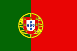
| Flag of Portugal | |
One of the oldest countries in Europe, its territory has been continuously settled, invaded and fought over since prehistoric times. The territory was first inhabited by pre-Roman and Celtic peoples who had contact with Phoenicians, ancient Greeks and Carthaginians. It was later ruled by the Romans, followed by the invasions of Germanic peoples and the Islamic invasion by the Moors, whose rule was eventually expelled during the Reconquista. Founded first as a county of the Kingdom of León in 868, gained its independence as the Kingdom of Portugal with the Treaty of Zamora in 1143.
Currency / Language
| ISO | Currency | Symbol | Significant figures |
|---|---|---|---|
| EUR | Euro | € | 2 |
| ISO | Language |
|---|---|
| PT | Portuguese language |


