Penang (Pulau Pinang)
 |
 |
Penang is the 8th most populated state in Malaysia. Its population stood at nearly 1.767 million, while its population density was as high as 1,684 /km2. It has among the nation's highest population densities and is one of the country's most urbanised states. Seberang Perai is Malaysia's second-largest city by population. Its heterogeneous population is highly diverse in ethnicity, culture, language and religion. Aside from the three main races, the Malays, Chinese, and Indians, Penang is home to significant Eurasian, Siamese and expatriate communities. A resident of Penang is colloquially known as a Penangite or Penang Lang (Penang Hokkien: 庇能儂; Tâi-lô: Pī-néeng-lâng) in Penang Hokkien due to the significant Penangite Chinese population.
Penang's modern history began in 1786, upon the establishment of George Town by Francis Light. Penang formed part of the Straits Settlements in 1826, which became a British crown colony in 1867. Direct British rule was only briefly interrupted during World War II, when Japan occupied Penang; the British retook Penang in 1945. Penang was later merged with the Federation of Malaya (now Malaysia), which gained independence from the British in 1957.
Following the decline of its entrepôt trade towards the 1970s, Penang's economy was reoriented by the central government towards manufacturing. Today, it has become one of Malaysia's most vital economic powerhouses. Penang is the nation's third highest Human Development Index (HDI) state, after Kuala Lumpur and Selangor.
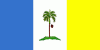
The name Penang comes from the modern Malay name Pulau Pinang which means "areca nut island". The State of Penang is also referred to as the Pearl of the Orient and "The Island of Pearls" (in Malay: Pulau Mutiara).
Penang Island was originally known by native seafarers as Pulau Ka-Satu, meaning The First Island, because it was the largest island encountered on the trading sea-route between Lingga and Kedah. Similarly, the Siamese, then the overlord of Kedah, referred to the island as Koh Maak (เกาะหมาก).
In the 15th century, Penang Island was referred to as in the navigational drawings used by Admiral Zheng He of Ming China. Emanuel Godinho de Eredia, a 16th-century Portuguese historian, also referred to the island as Pulo Pinaom in the Description of Malacca.
Map - Penang (Pulau Pinang)
Map


Country - Malaysia
 |
 |
| Flag of Malaysia | |
Malaysia has its origins in the Malay kingdoms, which, from the 18th century on, became subject to the British Empire, along with the British Straits Settlements protectorate. Peninsular Malaysia was unified as the Malayan Union in 1946. Malaya was restructured as the Federation of Malaya in 1948 and achieved independence on 31 August 1957. The independent Malaya united with the then British crown colonies of North Borneo, Sarawak, and Singapore on 16 September 1963 to become Malaysia. In August 1965, Singapore was expelled from the federation and became a separate independent country.
Currency / Language
| ISO | Currency | Symbol | Significant figures |
|---|---|---|---|
| MYR | Malaysian ringgit | RM | 2 |
| ISO | Language |
|---|---|
| ZH | Chinese language |
| EN | English language |
| MS | Malay language |
| ML | Malayalam language |
| PA | Panjabi language |
| TA | Tamil language |
| TE | Telugu language |
| TH | Thai language |