Peshawar
Peshawar (پېښور ; ; ; ) is the sixth most populous city in Pakistan, with a population of over 2.3 million. It is situated in the north-west of the country, close to the International border with Afghanistan. It is the capital of the province of Khyber Pakhtunkhwa, where it is the largest city. Peshawar is primarily populated by Pashtuns, who comprise the second-largest ethnic group in the country. Situated in the Valley of Peshawar, a broad area situated east of the historic Khyber Pass, Peshawar's recorded history dates back to at least 539 BCE, making it one of the oldest cities in South Asia. Peshawar is among the oldest continuously inhabited cities of the country.
The area encompassing modern-day Peshawar is mentioned in Vedic scriptures; it served as the capital of the Kushan Empire during the rule of Kanishka and was home to the Kanishka Stupa, which was among the tallest buildings in the ancient world. Peshawar was then ruled by the Hephthalites, followed by the Hindu Shahis, before the arrival of a variety of Muslim empires. The city was an important trading centre of the Mughal Empire before becoming part of the Durrani Empire in 1747, after which it served as the Durrani winter capital from 1776 until the capture of the city by the Sikh Empire in 1823. In 1849, the city was captured by the East India Company and subsequently became part of British Raj, under whose rule it remained until the Partition of British India and subsequent independence of Pakistan in 1947.
The modern name of the city "Peshawar" is possibly derived from the [reconstructed] Sanskrit word "Purushapura" (पुरूषपुर Puruṣapura, meaning "City of Men" or “City of Purusha"). It was named so by Mughal Emperor Akbar from its old name Parashawar, the meaning of which Akbar didn't understand. The ruler of the city during its founding may have been a Hindu raja (king) named Purush; the word pur means "city" in Sanskrit. Sanskrit, written in the Kharosthi script, was the literary language employed by the Buddhist kingdoms which ruled over the area during its earliest recorded period. The city's name may also be derived from the Sanskrit name for "City of Flowers," Poshapura, a name found in an ancient Kharosthi inscription that may refer to Peshawar.
Chinese Buddhist monk Xuanzang's seventh century account of a city in Gandhara called the city Po-la-sha-pu-lo (Chinese: 布路沙布邏, bùlùshābùló), and an earlier fifth century account by Fa-Hien records the city's name as Fou-lou-sha (Chinese: 弗樓沙, fùlóshā), the Chinese equivalent of the Sanskrit name of the city, Purushapura. An ancient inscription from the Shapur era identifies a city in the Gandhara valley by the name pskbvr, which may be a reference to Peshawar.
The Arab historian and geographer Al-Masudi noted that by the mid tenth century, the city was known as Parashāwar. The name was noted to be Purshawar and Purushavar by Al-Biruni.
The city began to be known as Peshāwar by the era of Emperor Akbar. The current name is said by some to have been based upon the Persian for "frontier town" or, more literally, "forward city," though transcription errors and linguistic shifts may account for the city's new name. One theory suggests that the city's name is derived from the Persian name "Pesh Awardan", meaning "place of first arrival" or "frontier city," as Peshawar was the first city in the Indian subcontinent after crossing the Khyber Pass. Akbar's bibliographer, Abu'l-Fazl ibn Mubarak, lists the city's name as both Parashāwar, transcribed in Persian as, and Peshāwar.
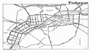
Map - Peshawar
Map


Country - Pakistan
 |
 |
| Flag of Pakistan | |
Pakistan is the site of several ancient cultures, including the 8,500-year-old Neolithic site of Mehrgarh in Balochistan, the Indus Valley civilisation of the Bronze Age, the most extensive of the civilisations of the Afro-Eurasia, and the ancient Gandhara civilization. The region that comprises the modern state of Pakistan was the realm of multiple empires and dynasties, including the Achaemenid; briefly that of Alexander the Great; the Seleucid, the Maurya, the Kushan, the Gupta; the Umayyad Caliphate in its southern regions, the Hindu Shahis, the Ghaznavids, the Delhi Sultanate, the Mughals, the Durranis, the Omani Empire, the Sikh Empire, British East India Company rule, and most recently, the British Indian Empire from 1858 to 1947.
Currency / Language
| ISO | Currency | Symbol | Significant figures |
|---|---|---|---|
| PKR | Pakistani rupee | ₨ | 2 |
| ISO | Language |
|---|---|
| EN | English language |
| PA | Panjabi language |
| PS | Pashto language |
| SD | Sindhi language |
| UR | Urdu |