Pindigheb (Pindi Gheb)
Pindigheb (or Pindi Gheb), is a town in Punjab province Pakistan and seat of Pindi Gheb Tehsil (an administrative subdivision) of Attock District. Western route of China Pakistan Economic Corridor (CPEC) passes through Pindigheb.
The Imperial Gazetteer of India, compiled over a century ago during British rule, described the town as follows:
Pindi Gheb Town.-Head-quarters of the subdivision and tahsil of the same name in Attock District, Punjab, situated in 33º 14' N. and 72º 16' E., 21 miles from Jand station on the North-Western Railway. Population (1901), 8,452. Formerly known as Pindi Gheb drives from two words pindi which means twon and Gheba was Jhodar tribe prince gheba and is now the ancestral home of the Jhodar Rajput Malik, who founded it in the thirteenth century. The municipality was created in 1873. The income and expenditure during the ten years ending 1902-3 averaged Rs. 4,400. In 1903-4 the income was Rs. 5,200, chiefly from octroi; and the expenditure was Rs. 5,800. A vernacular middle school is maintained by the municipality, and a dispensary by Government.
In 997 CE, Sultan Mahmud Ghaznavi, took over the Ghaznavid dynasty empire established by his father, Sultan Sebuktegin, In 1005 he conquered the Shahis in Kabul in 1005, and followed it by the conquests of Punjab region. The Delhi Sultanate and later Mughal Empire ruled the region. The Punjab region became predominantly Muslim due to missionary Sufi saints whose dargahs dot the landscape of Punjab region.
After the decline of the Mughal Empire, the Sikh invaded and occupied Attock District. The Muslims faced severe restrictions during the Sikh rule. During the period of British rule, Attock District increased in population and importance.
The predominantly Muslim population supported Muslim League and Pakistan Movement. After the independence of Pakistan in 1947. The name of incumbent Assistant Commissioner of Pindi Gheb sub division is Ijaz Abdul Karim.
Map - Pindigheb (Pindi Gheb)
Map
Country - Pakistan
 |
 |
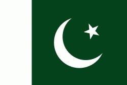
| Flag of Pakistan | |
Pakistan is the site of several ancient cultures, including the 8,500-year-old Neolithic site of Mehrgarh in Balochistan, the Indus Valley civilisation of the Bronze Age, the most extensive of the civilisations of the Afro-Eurasia, and the ancient Gandhara civilization. The region that comprises the modern state of Pakistan was the realm of multiple empires and dynasties, including the Achaemenid; briefly that of Alexander the Great; the Seleucid, the Maurya, the Kushan, the Gupta; the Umayyad Caliphate in its southern regions, the Hindu Shahis, the Ghaznavids, the Delhi Sultanate, the Mughals, the Durranis, the Omani Empire, the Sikh Empire, British East India Company rule, and most recently, the British Indian Empire from 1858 to 1947.
Currency / Language
| ISO | Currency | Symbol | Significant figures |
|---|---|---|---|
| PKR | Pakistani rupee | ₨ | 2 |
| ISO | Language |
|---|---|
| EN | English language |
| PA | Panjabi language |
| PS | Pashto language |
| SD | Sindhi language |
| UR | Urdu |


