Map - Plateaux Department (Republic of the Congo) (Plateaux)

Plateaux Department  (Plateaux)
Plateaux is a department of the Republic of the Congo in the central part of the country. It borders the departments of Cuvette, Lékoumou, and Pool, and internationally, the Democratic Republic of the Congo on the east and Gabon on the west. The regional capital is Djambala. Principal cities and towns include Gamboma and Lekana.

Plateaux Department is divided into eleven districts:

 
Map - Plateaux Department  (Plateaux)
Country - Republic_of_the_Congo
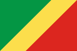
Flag of the Republic of the Congo
The Republic of the Congo (République du Congo, Republíki ya Kongó), also known as Congo-Brazzaville, the Congo Republic or simply either Congo or the Congo, is a country located on the western coast of Central Africa to the west of the Congo River. It is bordered to the west by Gabon, to its northwest by Cameroon and its northeast by the Central African Republic, to the southeast by the Democratic Republic of the Congo, to its south by the Angolan exclave of Cabinda and to its southwest by the Atlantic Ocean.

The region was dominated by Bantu-speaking tribes at least 3,000 years ago, who built trade links leading into the Congo River basin. Congo was formerly part of the French colony of Equatorial Africa. The Republic of the Congo was established on 28 November 1958 and gained independence from France in 1960. It was a Marxist–Leninist state from 1969 to 1992, under the name People's Republic of the Congo. The country has had multi-party elections since 1992, but a democratically elected government was ousted in the 1997 Republic of the Congo Civil War. President Denis Sassou Nguesso who first came to power in 1979 ruled until 1992 and then again from 1997 onwards.
Map - Republic of the CongoRepublic_of_Congo_Map.jpg
Republic_of_Congo_Ma...
1034x1194
freemapviewer.org
Map - Republic of the Congo1000px-Congo_location_map.svg.png
1000px-Congo_locatio...
1000x1075
freemapviewer.org
Map - Republic of the CongoUn-congo-brazzaville.png
Un-congo-brazzaville...
2349x2947
freemapviewer.org
Map - Republic of the CongoCongo-Brazzaville_regions_map.png
Congo-Brazzaville_re...
2518x3008
freemapviewer.org
Map - Republic of the CongoRepublic_of_Congo_BMNG.png
Republic_of_Congo_BM...
1654x1925
freemapviewer.org
Currency / Language  
ISO Currency Symbol Significant figures
XAF Central African CFA franc Fr 0
Neighbourhood - Country  
  •  Angola 
  •  Cameroon 
  •  Central African Republic 
  •  Democratic Republic of the Congo 
  •  Gabon 
Administrative Subdivision
Country, State, Region,...
City, Village,...