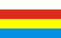
Podlachian Voivodeship (Podlaskie Voivodeship)
 |
 |
It borders on Masovian Voivodeship to the west, Warmian-Masurian Voivodeship to the northwest, Lublin Voivodeship to the south, the Belarusian oblasts of Grodno and Brest to the east, the Lithuanian Counties of Alytus and Marijampolė to the northeast, and the Kaliningrad Oblast of Russia to the north.
The province was created on 1 January 1999, pursuant to the Polish local government reforms adopted in 1998, from the former Białystok and Łomża Voivodeships and the eastern half of the former Suwałki Voivodeship.
The voivodeship takes its name from the historic region of Poland called Podlasie, or in Latin known as Podlachia.
There are two opinions regarding the origin of the region's name. People often derive it from the Proto-Slavic les or las, meaning "forest", i.e., it is an area "by the wood(s)" or an "area of forests", which would bring Podlasie close in meaning to adjacent Polesia. This theory has been questioned, as it does not properly take into consideration the vowel shifts "a" > "e" > "i" in various Slavic languages (in fact, it mixes vowels from different languages). Heavily wooded Podlasie is home to the primeval Białowieża Forest and National Park, the habitat of the European wisent bison and tarpan.
A second view holds that the term comes from the expression pod Lachem, i.e., "under the Poles" (see: Lechia). Some claim it to mean "under Polish rule", which does not seem historically sound, as the area belonged to the Grand Duchy of Lithuania until 1569, and the southern part of it—until 1795.
A better variant of the latter theory holds that the name originates from the period when the territory was within the Trakai Voivodeship of the Grand Duchy of Lithuania, along the border with Mazovia Province, primarily a fief of the Poland of the Piasts, and later part of the Kingdom of Poland of the Jagiellons. Hence pod Lachem would mean "near the Poles", "along the border with Poland". The Lithuanian name of the region, Palenkė, has exactly this meaning.
Map - Podlachian Voivodeship (Podlaskie Voivodeship)
Map
Country - Poland
 |
 |
| Flag of Poland | |
Poland has a temperate transitional climate and its territory traverses the Central European Plain, extending from Baltic Sea in the north to Sudeten and Carpathian Mountains in the south. The longest Polish river is the Vistula, and Poland's highest point is Mount Rysy, situated in the Tatra mountain range of the Carpathians. The country is bordered by Lithuania and Russia to the northeast, Belarus and Ukraine to the east, Slovakia and the Czech Republic to the south, and Germany to the west. It also shares maritime boundaries with Denmark and Sweden.
Currency / Language
| ISO | Currency | Symbol | Significant figures |
|---|---|---|---|
| PLN | Polish złoty | zÅ‚ | 2 |
| ISO | Language |
|---|---|
| PL | Polish language |


