Prague 18 (Praha 18)
Prague 18 is a municipal district (městská část) in Prague. It is located in the north-eastern part of the city. It is formed by one cadastre Letňany. As of 2008, there were 16,433 inhabitants living in Prague 18.
The administrative district (správní obvod) of the same name consists of municipal districts Prague 18 and Čakovice.
* Prague 18 - Letňany - Official homepage
The administrative district (správní obvod) of the same name consists of municipal districts Prague 18 and Čakovice.
* Prague 18 - Letňany - Official homepage
Map - Prague 18 (Praha 18)
Map


Country - Czech_Republic
 |
 |
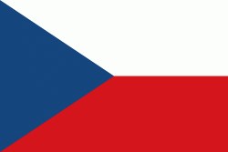
| Flag of the Czech Republic | |
The Duchy of Bohemia was founded in the late 9th century under Great Moravia. It was formally recognized as an Imperial State of the Holy Roman Empire in 1002 and became a kingdom in 1198. Following the Battle of Mohács in 1526, the whole Crown of Bohemia was gradually integrated into the Habsburg monarchy. The Protestant Bohemian Revolt led to the Thirty Years' War. After the Battle of White Mountain, the Habsburgs consolidated their rule. With the dissolution of the Holy Empire in 1806, the Crown lands became part of the Austrian Empire.
Currency / Language
| ISO | Currency | Symbol | Significant figures |
|---|---|---|---|
| CZK | Czech koruna | KÄ | 2 |
| ISO | Language |
|---|---|
| CS | Czech language |
| SK | Slovak language |