Praia
 |
The island of Santiago was discovered by António da Noli in 1460. The first settlement on the island was Ribeira Grande (Cidade Velha). The village Praia de Santa Maria was first mentioned around 1615 and grew near the natural harbour. The ports of Santiago were important ports of call for ships sailing between Portugal and the Portuguese colonies in Africa and South America. Between the end of the 16th century and the end of the 18th century, both Ribeira Grande and Praia suffered many pirate attacks, including those by Francis Drake (1585) and Jacques Cassard (1712).
Due to its strategic position on a plateau it had better protection against pirate attacks, which gave it a large advantage over the older city of Ribeira Grande (Cidade Velha). It gradually superseded Cidade Velha to become the most important settlement of Cape Verde, and became the capital of Cape Verde in 1770. The naval battle of Porto Praya took place at Praia Harbour on 16 April 1781, as Portugal was neutral, it involved Great Britain and France and ended in a tactical draw and French strategic victory. Praia was the first stop of Charles Darwin's voyage with HMS Beagle in 1832.
In the course of the 19th century, the Plateau was completely redeveloped with streets according to a grid plan, lined with grand colonial buildings and mansions. Praia officially became a city (cidade) in 1858, which secured its status as the capital of Cape Verde, concentrating political, religious and economic roles. In the early 1920s, the population was around 21,000.
As in other parts of the archipelago, resistance against Portuguese rule rose in the 1950s. There was no open independence war like in Guinea-Bissau; after the 1974 Carnation Revolution in Portugal and the resulting end of the Portuguese Colonial War, Cape Verde declared independence in July 1975. After independence, Praia underwent a demographic boom, receiving migrating movements from all the islands. As a result, 56% of the entire population of Cape Verde resides in Santiago; and 29% in the Municipality of Praia alone. Its estimated population has reached 151,436 (2015). On 28 June 1985, Praia became member of UCCLA, the Union of Luso – Afro-Americo-Asiatic Capital Cities, an international organization.
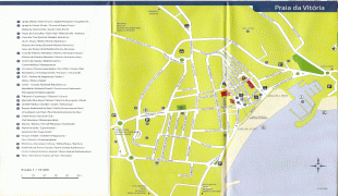
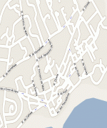
Map - Praia
Map


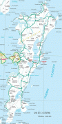

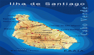

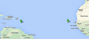
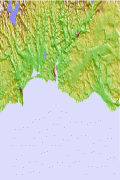
Country - Cape_Verde
 |
 |
The Cape Verde archipelago was uninhabited until the 15th century, when Portuguese explorers discovered and colonized the islands, thus establishing the first European settlement in the tropics. Because the Cape Verde islands were located in a convenient location to play a role in the Atlantic slave trade, Cape Verde became economically prosperous during the 16th and 17th centuries, attracting merchants, privateers, and pirates. It declined economically in the 19th century after the suppression of the Atlantic slave trade, and many of its inhabitants emigrated during that period. However, Cape Verde gradually recovered economically by becoming an important commercial center and useful stopover point along major shipping routes. In 1951, Cape Verde was incorporated as an overseas department of Portugal, but its inhabitants continued to campaign for independence, which they achieved in 1975.
Currency / Language
| ISO | Currency | Symbol | Significant figures |
|---|---|---|---|
| CVE | Cape Verde escudo | Esc or $ | 2 |
| ISO | Language |
|---|---|
| PT | Portuguese language |