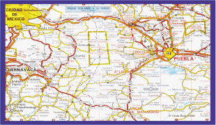
Puebla (Estado de Puebla)
 |
 |
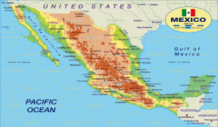
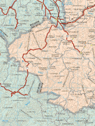
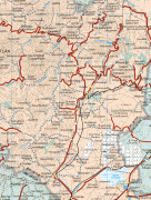
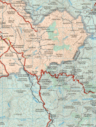
It is located in east-central Mexico and is bordered by the states of Veracruz to the north and east, Hidalgo, México, Tlaxcala and Morelos to the west, and Guerrero and Oaxaca to the south. The origins of the state lie in the city of Puebla, which was founded by the Spanish in this valley in 1531 to secure the trade route between Mexico City and the port of Veracruz. By the end of the 18th century, the area had become a colonial province with its own governor, which would become the State of Puebla, after the Mexican War of Independence in the early 19th century. Since that time the area, especially around the capital city, has continued to grow economically, mostly through industry, despite being the scene of a number of battles, the most notable of which being the Battle of Puebla. Today, the state is one of the most industrialized in the country, but since most of its development is concentrated in Puebla and other cities, many of its rural areas are undeveloped.
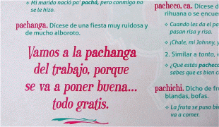
Culturally, the state is home to the china poblana, mole poblano, active literary and arts scenes, and festivals such as Cinco de Mayo, Ritual of Quetzalcoatl, Day of the Dead celebrations (especially in Huaquechula) and Carnival (especially in Huejotzingo). It is home to five major indigenous groups: Nahuas, the Totonacs, the Mixtecs, the Popolocas and the Otomi, which can mostly be found in the far north and the far south of the state.
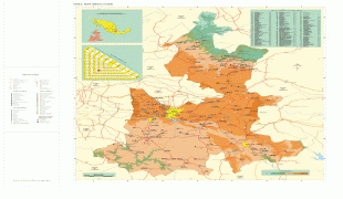
The state is in the central highlands of Mexico between the Sierra Nevada and the Sierra Madre Oriental. It has a triangular shape with its narrow part to the north. It borders the states of Veracruz, Oaxaca, Guerrero, Morelos, State of Mexico, Tlaxcala and Hidalgo. The state occupies 33,919 km2, ranking 20th of 31 states in size, and has 4,930 named communities.
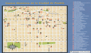
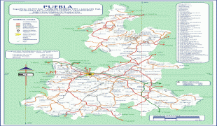
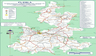
Map - Puebla (Estado de Puebla)
Map


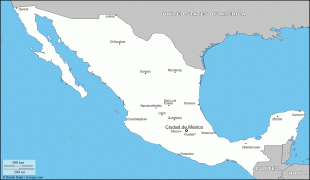

Country - Mexico


Currency / Language
| ISO | Currency | Symbol | Significant figures |
|---|---|---|---|
| MXV | Mexican Unidad de Inversion | 2 | |
| MXN | Mexican peso | $ | 2 |
| ISO | Language |
|---|---|
| ES | Spanish language |

