Puerto Cabezas Airport (Bilwi Airport)
Puerto Cabezas Airport is an airport serving Puerto Cabezas, North Caribbean Coast Autonomous Region. It is located approximately one hour from Managua by aircraft. Operated by the state of Nicaragua, it mainly serves the city of Puerto Cabezas and Bluefields located close to the northeast corner of the country.
There are plans to make the airport an international airport. The Airport Management Authority of Nicaragua has drawn up plans for improving the paved areas, taxiways, ramps and an air terminal.
The new air terminal has a total area of 477 m2 and a 2400 m2 parking lot for 30 vehicles. The terminal facilities are modern and air-conditioned. Immigration and customs services are also provided, but must be coordinated by respective authorities.
| IATA Code | PUZ | ICAO Code | MNPC | FAA Code | |
|---|---|---|---|---|---|
| Telephone | Fax | ||||
| Home page |
Map - Puerto Cabezas Airport (Bilwi Airport)
Map
Country - Nicaragua
 |
 |
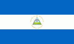
| Flag of Nicaragua | |
Originally inhabited by various indigenous cultures since ancient times, the region was conquered by the Spanish Empire in the 16th century. Nicaragua gained independence from Spain in 1821. The Mosquito Coast followed a different historical path, being colonized by the English in the 17th century and later coming under British rule. It became an autonomous territory of Nicaragua in 1860 and its northernmost part was transferred to Honduras in 1960. Since its independence, Nicaragua has undergone periods of political unrest, dictatorship, occupation and fiscal crisis, including the Nicaraguan Revolution of the 1960s and 1970s and the Contra War of the 1980s.
Currency / Language
| ISO | Currency | Symbol | Significant figures |
|---|---|---|---|
| NIO | Nicaraguan córdoba | C$ | 2 |
| ISO | Language |
|---|---|
| EN | English language |
| ES | Spanish language |


