Pyongyang
Pyongyang is one of the oldest cities in Korea. It was the capital of two ancient Korean kingdoms, Gojoseon and Goguryeo, and served as the secondary capital of Goryeo. Much of the city was destroyed during the First Sino-Japanese War, but it was revived under Japanese rule and became an industrial center. Following the establishment of North Korea in 1948, Pyongyang became its de facto capital. The city was again devastated during the Korean War, but was quickly rebuilt after the war with Soviet assistance.
Pyongyang is the political, industrial and transport center of North Korea. It is home to North Korea's major government institutions, as well as the ruling Workers' Party of Korea which has its headquarters in the Forbidden City.
The city's other historic names include Ryugyong, Kisong, Hwangsong, Rakrang, Sŏgyong, Sodo, Hogyong, Changan, and Heijō (during Japanese rule in Korea). There are several variants. During the early 20th century, Pyongyang came to be known among missionaries as being the "Jerusalem of the East", due to its historical status as a stronghold of Christianity, namely Protestantism, especially during the Pyongyang revival of 1907.
After Kim Il-sung's death in 1994, some members of Kim Jong-il's faction proposed changing the name of Pyongyang to "Kim Il-sung City", but others suggested that North Korea should begin calling Seoul "Kim Il-sung City" instead and grant Pyongyang the moniker "Kim Jong-il City". In the end, neither proposal was implemented.
Map - Pyongyang
Map


Country - North_Korea
 |
 |
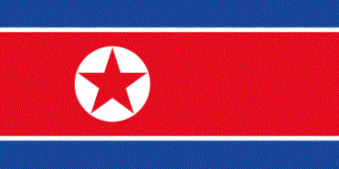
| Flag of North Korea | |
In 1910, Korea was annexed by the Empire of Japan. In 1945, after the Japanese surrender at the end of World War II, Korea was divided into two zones along the 38th parallel, with the north occupied by the Soviet Union and the south occupied by the United States. Negotiations on reunification failed, and in 1948, separate governments were formed: the socialist and Soviet-aligned Democratic People's Republic of Korea in the north, and the capitalist, Western-aligned Republic of Korea in the south. The Korean War began in 1950, with an invasion by North Korea, and lasted until 1953. The Korean Armistice Agreement brought about a ceasefire and established a demilitarized zone (DMZ), but no formal peace treaty has ever been signed.
Currency / Language
| ISO | Currency | Symbol | Significant figures |
|---|---|---|---|
| KPW | North Korean won | â‚© | 2 |
| ISO | Language |
|---|---|
| KO | Korean language |