Querétaro (Estado de Querétaro)
 |
 |
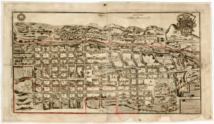
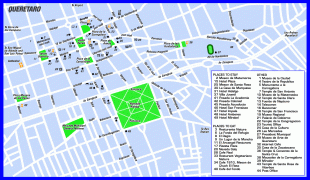
The state is one of the smallest in Mexico, but also one of the most heterogeneous geographically, with ecosystems varying from deserts to tropical rainforest, especially in the Sierra Gorda, which is filled with microecosystems. The area of the state was located on the northern edge of Mesoamerica, with both the Purépecha Empire and Aztec Empire having influence in the extreme south, but neither really dominating it. The area, especially the Sierra Gorda, had a number of small city-states, but by the time the Spanish arrived, the area was independent from Empirical powers. Small agricultural villages and seminomadic peoples lived in the area. Spanish conquest was focused on the establishment of Santiago de Querétaro, which still dominates the state culturally, economically and educationally.
For many years, the name of the state was Querétaro de Arteaga, but in 2010 the State Legislature approved the adoption of the simpler name Querétaro.
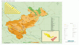
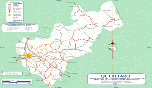
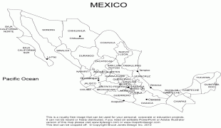
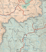
Querétaro is located in the north-central area of the country of Mexico, connecting the wetter climes of the south with the drier deserts of the north. The state is divided into 18 municipalities: Amealco de Bonfil, Arroyo Seco, Cadereyta de Montes, Colón, Corregidora, El Marqués, Ezequiel Montes, Huimilpan, Jalpan de Serra, Landa de Matamoros, Pedro Escobedo Municipality, Peñamiller, Pinal de Amoles, Querétaro, San Joaquín, San Juan del Río, Tequisquiapan and Tolimán.
Three of Mexico’s geographic zones cover parts of the state. The Mesa del Centro is in the center-west of the state, and mostly consists of small mesas with an average altitude of 2000 m above sea level (ASL). A few elevations reach over 3000 m. The Sierra Madre Oriental occupies the northeast of the state and includes the cities of Huasteca area. The topography of this area is rugged, with long mountain chains and narrow valleys. Elevations here range between 900 m and 3000 m m ASL. The Trans-Mexican Volcanic Belt occupies about half of the state in the center and south. The area is mostly volcanic rock with peaks and mesas between 200 m and 3000 m and valleys between 1800 m and 1900 m ASL.
The state is divided into five geographical regions: The Sierra Gorda, El Semidesierto Queretano, Los Valles Centrales, El Bajío Queretano and La Sierra Queretana. The Sierra Gorda is located in the north of the state and is part of the Sierra Madre Oriental, specifically in a subprovince called the Huasteco Karst. It is found in the municipalities of Arroyo Seco, Jalpan de Serra, Landa de Matamoros, Pinal de Amoles and San Joaquín and covers an area of 3,789km2 or 32.2% of the state. The topography is rugged, with high elevations and steep valleys. It is a conjunction of mountains and hills formed mostly by limestone, with wide contrasts in climates and vegetation. They range from near desert conditions to forests of pine and holm oak to the tropical rainforests of the Huasteca area in the state of San Luis Potosí. The Sierra Gorda was made a biosphere reserve in 1997, the Reserva de la Biosfera de la Sierra Gorda, to protect its abundance of species and ecosystems. In 2001, the area was registered with the Man and the Biosphere Programme of UNESCO. This area is managed by la Comisión Nacional de Áreas Naturales Protegidas of the Secretariat of Environment and Natural Resources federal agency.
El Semidesierto Queretano (Querétaro Semidesert) is a wide strip that crosses the state from east to west, which is dry due to the blocking of moist air from the Gulf by the Sierra Madre Oriental. The area is found in the municipalities of Cadereyta de Montes, Colón, Peñamiller and Tolimán, with an area of 3,415.6km2 or 29% of the state. As it is near the mountain range, its topography is relatively rugged. Los Valles Centrales (Central Valleys) is in the center of the state, overlapping almost all of the area formed by the Trans-Mexican Volcanic Belt, with the exception of the north of the El Marqués municipality, which is in the Mesa del Centro. The continental divide runs through here marked by the Sierra Queretana, the El Macizo and El Zamoarano mountain chains. This area occupies the municipalities of Ezequiel Montes, El Marqués, Pedro Escobedo and San Juan del Río with an extension of 2,480.2kmw or 21.1% of the state. El Bajío Queretano is in the western part of the state, which is a low elevation area that extends into neighboring Guanajuato. This area covers 1,005.7km2 or 8.5% of the state, and contains low hills and small mountain chains that are part of the Trans Mexican Volcanic Belt. La Sierra Queretana (Querétaro Sierra Mountains) is in the extreme south of the state, and also part of the Trans-Mexican Volcanic Belt. It is mostly found in the municipalities of Amealco de Bonfil and Huimilpan, covering an area of 1,078.3 km or 9.2% of the state. The area has high peaks and plains that narrow into valleys and canyons. Some of the flat areas border the Lerma River.
The state contains two river basins: the Lerma/Santiago and the Pánuco. The first is represented by the Lerma and La Laja Rivers and the second is represented by the Tamuín and Moctezuma Rivers. Other important rivers include the Santa María and the San Juan. These rivers contain 16 dams, including the Santa Catarina, El Batán, Constitution de 1917 and the San Ildefonso.
Most of the state is dry, with the exception of the north, which is temperate and rainy. The average temperature is 18 °C. Three well-defined climate areas are in the state. The south has a temperate and fairly wet climate. Temperatures are relatively stable through the year, ranging from an average of between 12 and 18 °C, with most rain falling in the summer. This region includes the municipalities of Amealco, Huimilpan, Pedro Escobedo, San Juan del Río and Corregidora. The center and west have drier and hotter climates, especially in areas under 2,000 m ASL. Here, the Sierra Madre Oriental and parts of the Trans Mexican Volcanic Belt impede moist air from arriving. This dry area includes the municipalities of Querétaro, Corregidora, El Marqués, Peñamiller, Esequiel Montes, Cadereyta, San Juan del Río, Tolimán and Tequisquiapan. The Sierra Madre Oriental area has climates that range from temperate to cold, varying significantly from north to south and even more due to altitude. The north tends to be warmer than the south, but average temperatures can range from 18 to 28 C in lower elevations and between 14 to 20 C in higher elevations.
The state’s ecosystems have 18 different classifications ranging from tropical rainforest to arid scrub brush. Deciduous rainforest is found in parts of the north, center and west of the state such as Jalpan de Serra, Arroyo Seco and Landa de Matamoros. Small deciduous forests are found in Jalpan de Serra and Landa de Matamoros. Oyamel forests are found in the highest elevations of El Zamorano in the municipalities of El Marqués and Colón. Pure pine forests are found in Cadereyta de Montes, Pinal de Amoles, San Joaquín and Landa de Matamoros. Mixed pine and holm oak forests are found in the Sierra de El Zamorano and the El Lobo region, opposite the Sierra Madre Oriental. Deciduous oak forests are found in the municipalities of Amealco de Bonfil, Landa de Matamoros, El Marqués, and a number of others, but only at altitudes between 1,600 and 2,800 m ASL. Juniper and cedar forests are found in Pinal de Amoles, Landa de Matamoros, San Joaquín and Cadereyta de Montes at altitudes of between 1,390 and 2,500 m, generally on low hills. Mesquite forests are scarce given that they tend to grow on land suitable for agriculture, but some can still be found in Pedro Escobedo, San Juan del Río, Cadereyta de Montes and other municipalities. The two types of grasslands are those with some trees and those with none. The latter is much more common and found in various parts of the south of the state. Grasslands dotted with trees are found only in the municipality of Querétaro. The other five ecosystems are dominated by various types of arid scrub brush, ranging from those dominated by thorns, without thorns and intermixed with various types of cactus.
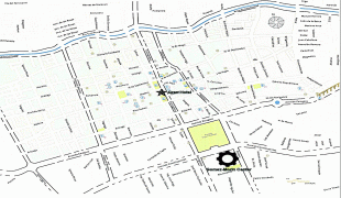
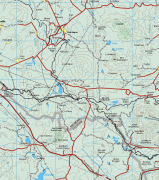
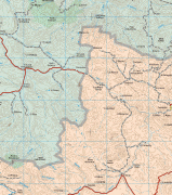
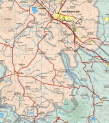
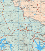
Map - Querétaro (Estado de Querétaro)
Map


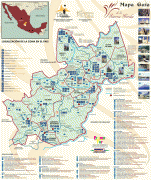


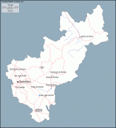
Country - Mexico


Currency / Language
| ISO | Currency | Symbol | Significant figures |
|---|---|---|---|
| MXV | Mexican Unidad de Inversion | 2 | |
| MXN | Mexican peso | $ | 2 |
| ISO | Language |
|---|---|
| ES | Spanish language |