Rafah (Rafaḩ)
Rafah (رفح, ) is an important city in North Sinai and Egypt's eastern border with the Gaza Strip. It is the capital of Rafah center in North Sinai Governorate, and is situated on the eastern Mediterranean coast of Egypt.
Rafah is the site of the Rafah Border Crossing, the sole crossing point between Egypt and the Gaza Strip. The Egyptian government announced in early 2015 that it would raze the entire city and build a new settlement for its residents, in order to expand a security buffer between Egypt and Gaza Strip. The Egyptian military reportedly began bulldozing sections of Rafah in late 2014.
When Israel withdrew from the Sinai in 1982, Rafah was split into a Gazan part and an Egyptian part, dividing families, separated by barbed-wire barriers. The core of the city was destroyed by Israel and Egypt to create a large buffer zone.
During the 2011 Egyptian protests, anti-government rioters attacked and killed three police officers in the town.
In October 2014, the Egyptian government announced plans to relocate the population and completely demolish the city in order to enlarge the buffer zone between Egypt and Gaza. Between July 2013 and August 2015, Egyptian authorities demolished at least 3,255 residential, commercial, administrative, and community buildings along the border, forcibly evicting thousands of people.
In June 2015 Egypt completed the digging of a ditch at the Rafah Crossing Point, 20 meters wide by 10 meters deep. It is located two kilometers from the border with Gaza outside of Rafah City and part of the enlarged buffer zone. Expansion of the trench along with watchtowers was planned. In November 2021, Egypt and Israel signed an agreement that allows Egypt to increase its military presence in Rafah.
Map - Rafah (Rafaḩ)
Map
Country - United_Arab_Republic
 |
 |
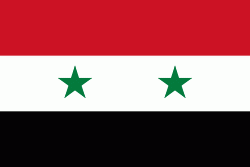
| Flag of Egypt | |
The republic was led by Egyptian President Gamal Abdel Nasser. The UAR was a member of the United Arab States, a loose confederation with the Mutawakkilite Kingdom of Yemen, which was dissolved in 1961.
Currency / Language
| ISO | Currency | Symbol | Significant figures |
|---|---|---|---|
| EGP | Egyptian pound | £ or جم | 2 |
| ISO | Language |
|---|---|
| AR | Arabic language |
| EN | English language |
| FR | French language |


