Redange (Redange)
Redange is a canton in the northwest of Luxembourg. The capital is Redange, otherwise known as Redange-sur-Attert. It borders the cantons of Wiltz to the north, Diekirch and Mersch to the east, Capellen to the south and Belgium to the west (Province de Luxembourg).
The canton lies right on the border of the two main landscapes of Luxembourg.
To the north, the landscape is dominated by the Oesling mountain range, which is a part of the greater Ardennes region. This region is characterised by densely forested hills with an average altitude of 400 to 500m above sealevel, with the highest point being Napoléonsgaard standing at 554m.
Furthermore this region shows deep valleys which were carved into the ground by rivers and streams, the Sauer and Wark being the most notable ones. The upper Sûre lake reservoir also lies partly within the Canton of Redange, at the border with the Canton of Wiltz.
The Oesling part of the Canton mainly comprises the communes of Rambrouch, Wahl and Grosbous with the communes of Ell, Redange and Préitzerdaul partly being situated in the Oesling region.
To the south, the landscape is dominated by the Gutland plain. This area is characterised by lower altitudes, averaging at around 300m above sealevel.
Wide shallow river valleys dominate the landscape with less forest coverage than in the north. The most important river in this region is the Attert.
The communes lying in the Gutland part of the Canton are Beckerich, Saeul, Useldange, and Vichten.
Map - Redange (Redange)
Map
Country - Luxembourg
 |
 |
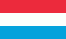
| Flag of Luxembourg | |
With an area of 2,586 km2, Luxembourg is one of the smallest countries in Europe, and the smallest not considered a microstate. In 2022, it had a population of 645,397, which makes it one of the least-populated countries in Europe, albeit with the highest population growth rate; foreigners account for nearly half the population. Luxembourg is a representative democracy headed by a constitutional monarch, Grand Duke Henri, making it the world's only remaining sovereign grand duchy.
Currency / Language
| ISO | Currency | Symbol | Significant figures |
|---|---|---|---|
| EUR | Euro | € | 2 |
| ISO | Language |
|---|---|
| FR | French language |
| DE | German language |
| LB | Luxembourgish language |


