Map - Riosucio, Caldas (Riosucio)

Riosucio (Riosucio)
Riosucio is a town and municipality in the department of Caldas in Colombia. It is best known for its biennial carnival, officially called the Carnival of Riosucio but commonly known by its former name of the "Carnival of the Devil", and is one of the biggest and most popular carnivals in Colombia. Located along the Colombian coffee growing axis, the municipality was made part of the "Coffee Cultural Landscape" UNESCO World Heritage Site in 2011.

The municipality is located in the west of the department. It is bounded by the municipality of Supía to the east, the municipality of Filadelfia to the south-east, the department of Risaralda to the south and west, and the department of Antioquia to the north. The total area of the municipality is 429.1 km2. The town of Riosucio lies at an altitude of 1783 meters above sea level, 91 km west of the departmental capital Manizales.
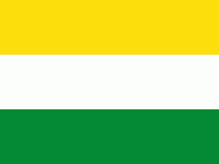
 
Map - Riosucio (Riosucio)
Map
Google Earth - Map - Riosucio, Caldas
Google Earth
Openstreetmap - Map - Riosucio, Caldas
Openstreetmap
Map - Riosucio - Esri.WorldImagery
Esri.WorldImagery
Map - Riosucio - Esri.WorldStreetMap
Esri.WorldStreetMap
Map - Riosucio - OpenStreetMap.Mapnik
OpenStreetMap.Mapnik
Map - Riosucio - OpenStreetMap.HOT
OpenStreetMap.HOT
Map - Riosucio - CartoDB.Positron
CartoDB.Positron
Map - Riosucio - CartoDB.Voyager
CartoDB.Voyager
Map - Riosucio - OpenMapSurfer.Roads
OpenMapSurfer.Roads
Map - Riosucio - Esri.WorldTopoMap
Esri.WorldTopoMap
Map - Riosucio - Stamen.TonerLite
Stamen.TonerLite
Country - Colombia
Currency / Language  
ISO Currency Symbol Significant figures
COP Colombian peso $ 2
ISO Language
ES Spanish language
Neighbourhood - Country  
  •  Panama 
  •  Brazil 
  •  Ecuador 
  •  Peru 
  •  Venezuela 
Administrative Subdivision
City, Village,...