Map - Rivas Department (Departamento de Rivas)

Rivas Department (Departamento de Rivas)
Rivas is a department of the Republic of Nicaragua. It covers an area of 2,162 km2 and has a population of 183,611 (2021 estimate). The department's capital is the city of Rivas.

Rivas is known for its fertile soil and beautiful beaches. Throughout the department, there are many sugar cane, plantain, tobacco, and other crop plantations. The department borders Lake Nicaragua to the east and the Pacific Ocean to the west. The southern part of the department borders with Costa Rica. A small fishermen village, called San Juan del Sur, has turned into a popular tourist attraction because of the great beaches in the area. Another major tourist attraction is Ometepe, a large volcanic island inhabited by about 32,000 people (2005 census). Some Nawat Nicarao tribals still live around small towns.

 
Map - Rivas Department (Departamento de Rivas)
Map
Openstreetmap - Map - Rivas Department
Openstreetmap
Map - Rivas Department - Esri.WorldImagery
Esri.WorldImagery
Map - Rivas Department - Esri.WorldStreetMap
Esri.WorldStreetMap
Map - Rivas Department - OpenStreetMap.Mapnik
OpenStreetMap.Mapnik
Map - Rivas Department - OpenStreetMap.HOT
OpenStreetMap.HOT
Map - Rivas Department - CartoDB.Positron
CartoDB.Positron
Map - Rivas Department - CartoDB.Voyager
CartoDB.Voyager
Map - Rivas Department - OpenMapSurfer.Roads
OpenMapSurfer.Roads
Map - Rivas Department - Esri.WorldTopoMap
Esri.WorldTopoMap
Map - Rivas Department - Stamen.TonerLite
Stamen.TonerLite
Country - Nicaragua
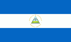
Flag of Nicaragua
Nicaragua, officially the Republic of Nicaragua , is the largest country in Central America, bordered by Honduras to the north, the Caribbean to the east, Costa Rica to the south, and the Pacific Ocean to the west. Managua is the country's capital and largest city. , it was estimated to be the second largest city in Central America. Nicaragua's multiethnic population of six million includes people of mestizo, Indigenous, European and African heritage. The main language is Spanish. Indigenous tribes on the Mosquito Coast speak their own languages and English.

Originally inhabited by various indigenous cultures since ancient times, the region was conquered by the Spanish Empire in the 16th century. Nicaragua gained independence from Spain in 1821. The Mosquito Coast followed a different historical path, being colonized by the English in the 17th century and later coming under British rule. It became an autonomous territory of Nicaragua in 1860 and its northernmost part was transferred to Honduras in 1960. Since its independence, Nicaragua has undergone periods of political unrest, dictatorship, occupation and fiscal crisis, including the Nicaraguan Revolution of the 1960s and 1970s and the Contra War of the 1980s.
Currency / Language  
ISO Currency Symbol Significant figures
NIO Nicaraguan córdoba C$ 2
Neighbourhood - Country  
  •  Costa rica 
  •  Honduras 
Administrative Subdivision
Country, State, Region,...
City, Village,...