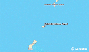
Rota International Airport (Rota International Airport)
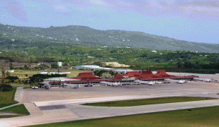
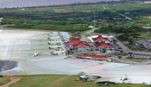
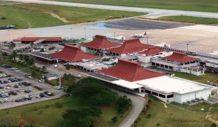
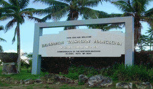
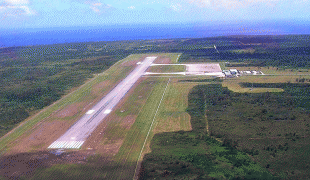
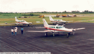
Rota International Airport, also known as Benjamin Taisacan Manglona International Airport, is a public airport located on Rota Island in the United States Commonwealth of the Northern Mariana Islands (CNMI), near the village of Sinapalo. The airport is owned by the Commonwealth Ports Authority. During WWII the Japanese constructed a single runway which the U.S. bombed out of commission. After the Marines took control of the island 300 men from the 48th U.S.Naval Construction Battalion made the airfield operational during Sept-Oct 1945 and extended to 5,000 ft. The runway was then used as an emergency landing strip for Tinian and Saipan airfields.
Although most U.S. airports use the same three-letter location identifier for the FAA and IATA, Rota International Airport is assigned GRO by the FAA and ROP by the IATA (which assigned GRO to Girona-Costa Brava Airport in Girona, Spain).
Rota International Airport covers an area of 800 acres (324 ha) which contains one paved runway (9/27) measuring 6,000 x 150 ft (1,829 x 46 m). For a twelve-month period ending March 31, 2006, the airport had 6,550 aircraft operations, an average of 17 per day: 94% air taxi, 4% general aviation and 2% military. Since the CNMI is a separate customs and U.S. immigration jurisdiction, Rota International Airport is a designated port of entry staffed by the CNMI Division of Customs and the U.S. Customs and Border Protection (which conducts immigration inspection only).
The Transportation Security Administration (TSA) began its Rota operations in March 2006. After the creation of TSA in 2002 but before it began operating at Rota Airport in 2006, passengers from Rota had to be screened upon arrival on Guam or Saipan. The lack of TSA at Rota Airport was a nuisance for passengers transiting from Guam through Rota to Saipan, who had to encounter screenings (either customs or security) at all three points.
| IATA Code | ROP | ICAO Code | PGRO | FAA Code | |
|---|---|---|---|---|---|
| Telephone | Fax | ||||
| Home page |
Map - Rota International Airport (Rota International Airport)
Map


Country - Northern_Mariana_Islands
 |
 |
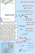
The United States Department of the Interior cites a landmass of 183.5 sqmi. According to the 2020 United States Census, 47,329 people were living in the CNMI at that time. The vast majority of the population resides on Saipan, Tinian, and Rota. The other islands of the Northern Marianas are sparsely inhabited; the most notable among these is Pagan, which for various reasons over the centuries has experienced major population flux, but formerly had residents numbering in the thousands.
Currency / Language
| ISO | Currency | Symbol | Significant figures |
|---|---|---|---|
| USD | United States dollar | $ | 2 |
| ISO | Language |
|---|---|
| CH | Chamorro language |
| ZH | Chinese language |
| EN | English language |
| TL | Tagalog language |