Map - Ruggell

Ruggell
Ruggell is a municipality of Liechtenstein. It is the northernmost and lowest elevated municipality. As of 2019, it has a population of 2,322.

The name is said to be from the Latin for "clearing the land" (roncale - ad roncalem). Most known for conservation areas and the historic St. Fridolin's Parish Church.

 
Map - Ruggell
Map
Google - Map - Ruggell
Google
Google Earth - Map - Ruggell
Google Earth
Openstreetmap - Map - Ruggell
Openstreetmap
Map - Ruggell - Esri.WorldImagery
Esri.WorldImagery
Map - Ruggell - Esri.WorldStreetMap
Esri.WorldStreetMap
Map - Ruggell - OpenStreetMap.Mapnik
OpenStreetMap.Mapnik
Map - Ruggell - OpenStreetMap.HOT
OpenStreetMap.HOT
Map - Ruggell - OpenTopoMap
OpenTopoMap
Map - Ruggell - CartoDB.Positron
CartoDB.Positron
Map - Ruggell - CartoDB.Voyager
CartoDB.Voyager
Map - Ruggell - OpenMapSurfer.Roads
OpenMapSurfer.Roads
Map - Ruggell - Esri.WorldTopoMap
Esri.WorldTopoMap
Map - Ruggell - Stamen.TonerLite
Stamen.TonerLite
Country - Liechtenstein
Flag of Liechtenstein
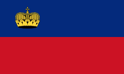
Liechtenstein, officially the Principality of Liechtenstein (Fürstentum Liechtenstein), is a German-speaking microstate located in the Alps between Austria and Switzerland. It is the sixth smallest nation worldwide. Liechtenstein is a semi-constitutional monarchy headed by the prince of Liechtenstein.

Liechtenstein is bordered by Switzerland to the west and south and Austria to the east and north. It is Europe's fourth-smallest country, with an area of just over 160 km2 and a population of 38,749. Divided into 11 municipalities, its capital is Vaduz, and its largest municipality is Schaan. It is also the smallest country to border two countries. Liechtenstein is a doubly landlocked country between Switzerland and Austria.
Currency / Language  
ISO Currency Symbol Significant figures
CHF Swiss franc Fr 2
ISO Language
DE German language
Neighbourhood - Country  
  •  Austria 
  •  Switzerland 
Administrative Subdivision
City, Village,...