Saint Andrew Parish (Parish of Saint Andrew)
* Area: 29 km² (11 mi²)
* Population: 6,700 (2000 estimates)
The following populated places are located in the parish of Saint Andrew:
* Camden Park (13.1725°N, -61.24139°W)
* Chauncey (13.16667°N, -61.23333°W)
* Clare Valley (13.16667°N, -61.25°W)
* Dubois (13.18333°N, -61.23333°W)
* Edinboro (13.15972°N, -61.23639°W)
* Francois (13.2°N, -61.21667°W)
Map - Saint Andrew Parish (Parish of Saint Andrew)
Map


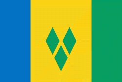
Country - Saint_Vincent_and_the_Grenadines
 |
 |
Its 369 km2 territory consists of the main island of Saint Vincent and, south of that, two-thirds of the northern part of the Grenadines, a chain of 32 smaller islands. Some of the Grenadines are inhabited—Bequia, Mustique, Union Island, Canouan, Petit Saint Vincent, Palm Island, Mayreau, Young Island—while others are not: Tobago Cays, Baliceaux, Battowia, Quatre, Petite Mustique, Savan and Petit Nevis. Most of Saint Vincent and the Grenadines lies within the Hurricane Alley.
Currency / Language
| ISO | Currency | Symbol | Significant figures |
|---|---|---|---|
| XCD | East Caribbean dollar | $ | 2 |
| ISO | Language |
|---|---|
| EN | English language |
| FR | French language |