Saint Philip (Saint Philip)
Saint Philip is a parish of Barbados at the easternmost end of the island. Saint Philip’s Parish Church was built as the Anglican parish church in 1640.
St. Philip has the largest land area of the 11 parishes of Barbados and has a relatively flat 'close to sea-level' terrain. St. Philip has the largest area of crop cultivation making it locally considered "the country". St. Philip does not have a 'true' city as some other parishes but rather 'areas' and 'villages'. Six Cross Roads is the largest area by virtue of both commercial and residential population and is the central hub for the parish.
Six Cross Roads, or locally known as just Six Roads, is a roundabout and its immediate neighborhood of which six roads converge extended in from the west 'from city' (Bridgetown); north-west toward Four Cross Roads and St. George; north-east toward Bushy Park; east toward Bayfield; south-east toward The Crane; south-west toward Oistins. Though there are a few areas in Barbados known as 'Four Cross Roads' there is only one area known as 'Six Cross Roads'. This parish is home to the only 'dependency' of Barbados called Culpepper Island. This tiny rock in the ocean is used as a feeding ground for sheep but cannot be reached unless by boat or by foot at low tide. The parish of Saint Philip is the main on-shore area of Barbados involved in the local oil industry.
St. Philip is well-known on the local music and entertainment scene for producing entertainers. Well-known calypsonians and performers Red Plastic Bag, John King, Ronnie D. and Lil Rick all hail from this eastern parish. It was also the first parish to have its own carnival - The St. Philip Carnival. A 2020 song by calypsonian Ronnie D called the 'St Philip Anthem' honours the parish.
Map - Saint Philip (Saint Philip)
Map
Country - Barbados
 |
 |
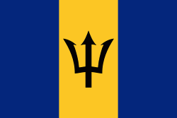
| Flag of Barbados | |
Inhabited by Kalinago people since the 13th century, and prior to that by other Amerindians, Spanish navigators took possession of Barbados in the late 15th century, claiming it for the Crown of Castile. It first appeared on a Spanish map in 1511. The Portuguese Empire claimed the island between 1532 and 1536, but abandoned it in 1620 with their only remnants being an introduction of wild boars for a good supply of meat whenever the island was visited. An English ship, the Olive Blossom, arrived in Barbados on 14 May 1625; its men took possession of the island in the name of King James I. In 1627, the first permanent settlers arrived from England, and Barbados became an English and later British colony. During this period, the colony operated on a plantation economy, relying on the labour of African slaves who worked on the island's plantations. Slavery continued until it was phased out through most of the British Empire by the Slavery Abolition Act 1833.
Currency / Language
| ISO | Currency | Symbol | Significant figures |
|---|---|---|---|
| BBD | Barbados dollar | $ | 2 |
| USD | United States dollar | $ | 2 |
| ISO | Language |
|---|---|
| EN | English language |


