San Pedro Department (Departamento de San Pedro)
 |
During the 17th and 18th centuries there was even greater political and population instability than in Concepción.
The Mbayá and Payagua native tribes threatened all the area between the Ypané (in the north) and Manduvirá (in the south) Rivers and the valley by the Jejuí River.
In 1660 the natives revolted in Arecajá against the postal parcel system, causing the disappearance of this town. To help regenerate this area, the Missions San Estanislao (1749), Villa del Rosario (1786) and San Pedro de Ycuamandiyú (1786) were founded.
The second department of the country, San Pedro, was created by law in 1906, and included the territories of Itacurubí del Rosario, Santa Rosa del Aguaray, Tacuatí, Unión, Ygatimi and Curuguaty, as well as the area of Canindeyú. Its limits were defined finally in 1973.
In 1941, the Bruderhof, an Anabaptist group fleeing Nazi persecution, settled in the area of Rosario. They lived here for over 20 years, founding a hospital. They left for North America in 1966.
Is hometown of important personalities of Paraguayan history, as Vicente Ignacio Iturbe and Juana María de Lara and the musician Rosita Mello, who is from Santaní.
Map - San Pedro Department (Departamento de San Pedro)
Map
Country - Paraguay
 |
 |
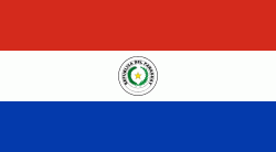
| Flag of Paraguay | |
Spanish conquistadores arrived in 1524, and in 1537 established the city of Asunción, the first capital of the Governorate of the Río de la Plata. During the 17th century, Paraguay was the center of Jesuit missions, where the native Guaraní people were converted to Christianity and introduced to European culture. After the expulsion of the Jesuits from Spanish territories in 1767, Paraguay increasingly became a peripheral colony, with few urban centers and settlers. Following independence from Spain in the early 19th century, Paraguay was ruled by a series of authoritarian governments characterized by nationalist, isolationist and protectionist policies. This period ended with the disastrous Paraguayan War (1864–70), during which the country lost half its prewar population and around 25–33% of its territory to the Triple Alliance of Argentina, Brazil and Uruguay. In the 20th century, Paraguay faced another major international conflict—the Chaco War (1932–35) against Bolivia—in which it prevailed. Afterwards, the country came under a succession of military dictators, culminating in the 35-year regime of Alfredo Stroessner, which lasted until his overthrow in 1989 by an internal military coup. This marked the beginning of Paraguay's democratic era, which continues to this day.
Currency / Language
| ISO | Currency | Symbol | Significant figures |
|---|---|---|---|
| PYG | Paraguayan guaranà | ₲ | 0 |
| ISO | Language |
|---|---|
| GN | Guarani language |
| ES | Spanish language |


